
gvSIG Team: Curso de manejo básico de la Suite gvSIG (Desktop, Online y Mapps) aplicado a la gestión municipal: Vídeo 3 – Tablas de atributos y selecciones en gvSIG Desktop
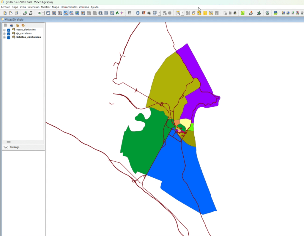
En el vídeo anterior cargamos capas y trabajamos su representación visual. En este tercero vamos a lo que hay “detrás” de la geometría: la tabla de atributos. Cualquier capa en un SIG lleva asociada una tabla con los datos descriptivos de cada elemento, y aprender a moverse con soltura entre mapa y tabla es uno de los hábitos más útiles del trabajo diario.
Partimos de un proyecto con tres capas centradas en un caso muy habitual en la gestión municipal, la organización electoral: mesas electorales (puntos), ejes de carreteras (líneas) y distritos electorales (polígonos). De paso nos sirve para repasar los tres tipos de geometría con los que vamos a trabajar a lo largo del curso. Sobre los distritos aplicamos una simbología por valores únicos, esta vez clasificando por un campo de la propia tabla.
...


![OSGeo Announcements: [OSGeo-Announce] TorchGeo and IBM TerraTorch Join Forces](https://www.osgeo.org/wp-content/uploads/terratorch-terrakit-scaled.png)


![OSGeo Announcements: [OSGeo-Announce] PROJ 9.8.1 is released](https://www.osgeo.org/wp-content/uploads/cropped-osgeo-emblem-rgb-1-32x32.png)

