- Vous êtes ici: Accéder au Wiki GeoRezo » Accueil : Wiki GeoRezo » Les logiciels en géomatique » QGIS » Plugins
Ceci est une ancienne révision du document !
Strict Standards: Declaration of syntax_plugin_googlemaps_googlemap::handle() should be compatible with DokuWiki_Syntax_Plugin::handle($match, $state, $pos, Doku_Handler $handler) in /var/www/html/web/wiki/lib/plugins/googlemaps/syntax/googlemap.php on line 169
Strict Standards: Declaration of syntax_plugin_googlemaps_googlemap::render() should be compatible with DokuWiki_Syntax_Plugin::render($format, Doku_Renderer $renderer, $data) in /var/www/html/web/wiki/lib/plugins/googlemaps/syntax/googlemap.php on line 169
Strict Standards: Declaration of syntax_plugin_nextpage::handle() should be compatible with DokuWiki_Syntax_Plugin::handle($match, $state, $pos, Doku_Handler $handler) in /var/www/html/web/wiki/lib/plugins/nextpage/syntax.php on line 69
Strict Standards: Declaration of syntax_plugin_nextpage::render() should be compatible with DokuWiki_Syntax_Plugin::render($format, Doku_Renderer $renderer, $data) in /var/www/html/web/wiki/lib/plugins/nextpage/syntax.php on line 69
Strict Standards: Declaration of syntax_plugin_pageindex::handle() should be compatible with DokuWiki_Syntax_Plugin::handle($match, $state, $pos, Doku_Handler $handler) in /var/www/html/web/wiki/lib/plugins/pageindex/syntax.php on line 177
Strict Standards: Declaration of syntax_plugin_pageindex::render() should be compatible with DokuWiki_Syntax_Plugin::render($format, Doku_Renderer $renderer, $data) in /var/www/html/web/wiki/lib/plugins/pageindex/syntax.php on line 177
Table des matières
Sommaire || Présentation de QGIS
Plugins
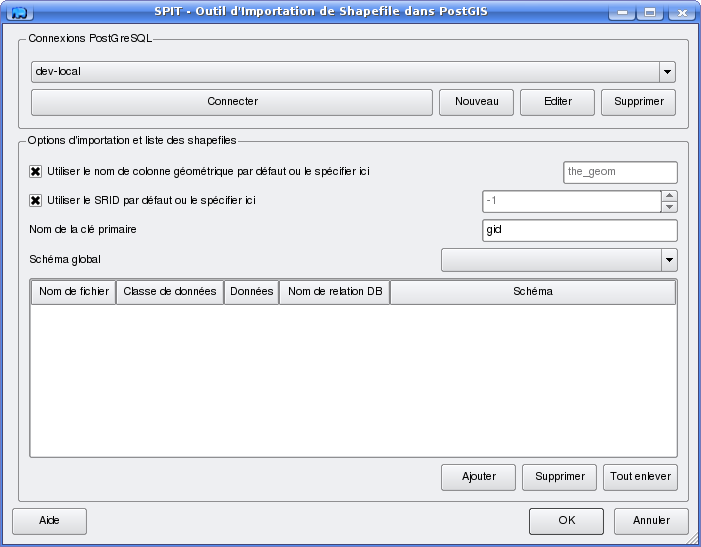
SPIT
Ce plugin permet d'importer des données au format Shapefile dans une base de données postgreSQL/PostGIS.
Text Delimiteur
Ce plugin permet d'importer un fichier CSV qui contient deux colonnes X et Y et de le sauver dans un fichier Shape. Après avoir lancé le plugin, et entrer les informations dans la fenêtre, cliquez sur Analyser pour vérifier que tout est correcte.
Attention il se peut que certain paramètre soit modifier après l'analyse, notamment les champs X et Y !
Cliquez sur Ok et la couche doit apparaître dans la fenêtre. Cliquez droit sur la couche et choisissez Sauver comme shapefile.


