
Nouvelles références ajoutées ces 180 derniers jours
18-06-2026
Rubrique : Roman - BD - Fiction
En 1976, la première édition de ce livre dans la " Petite collection Maspero " fit grand bruit. Il faut dire que le géographe Yves Lacoste y proposait une analyse iconoclaste : il fustigeait la " géographie des professeurs ", apparue au xixe siècle et progressivement devenue un discours idéologique masquant l'importance politique de toute réflexion sur l'espace – tandis que sa variante scolaire a longtemps été vue comme l'un des enseignements les plus rébarbatifs. Mais, surtout, il montrait qu'existait aussi une autre géographie, plus ancienne et toujours actuelle, la " géographie des états-majors ", ensemble de connaissances rapportées à l'espace et constituant un savoir stratégique utilisé par les dirigeants.
À rebours de ces deux conceptions, Lacoste affirmait que les questions soulevées par la géographie concernent en réalité tous les citoyens : des questions multiformes, à la croisée de nombreuses disciplines. La pertinence de ce livre devenu ... Lire la suite
26-04-2026
Rubrique : Télédétection / Application à l'urbanisme
Applisat a pour but d'encourager l'utilisation des informations issues des observations par satellite.
Applisat est piloté par le Commissariat général au développement durable (CGDD) avec l’aide du Centre d’études et d’expertise sur les risques, l’environnement, la mobilité et l’aménagement (Cerema), dans le cadre du plan d’applications satellitaires.
Applisat propose un espace de partage autour de 8 thématiques
Editeur : CGDD

Rubrique : Atlas
Cet atlas a été réalisé à partir des résultats du premier recensement général de la population, en Iran, qui ont été publiés en 1961 en persan, sous la forme de 119 fascicules pour chacun des districts de recensement (howzeh sarshomari) et de deux volumes de synthèse publiés en persan et en anglais en 1961 et en 1962. La réalisation de ce recensement a également été l'occasion de la cartographie exhaustive du territoire national.
Pour réaliser cet Atlas, une centaine de variables ont été collationnées à l’échelle des 119 districts de recensement (howzeh sarshomāri), par Abbas Rajaei et Hossein Mansourian, maîtres de conférences à la faculté de géographie de l’Université de Téhéran. Elles ont été analysées en 2019 avec Bernard Hourcade dans le cadre d’une collaboration académique avec le Centre de recherche sur le monde iranien (CeRMI), UMR 8041 (CNRS, Sorbonne nouvelle, Inalco, EPHE). Leur mise en forme cartographique a été réalisée ... Lire la suite
03-03-2026
Rubrique : Beaux Livres
La conception de l'État-nation, née de la Révolution française, portait en elle-même la mort des empires multinationaux. Depuis lors, ceux-ci ont tous disparu. Le dernier en date était l'Union soviétique. L'Atlas des empires recense et résume à l'aide de cartes plus d'une quarantaine d'empires au fil de l'histoire du monde. Il dégage des perspectives nouvelles sur les rapports conflictuels à la fois déstabilisateurs et créateurs entre les sociétés nomades et les sociétés sédentaires, de l'Antiquité à l'aube de la période moderne. Pour la première fois, on peut mesurer de façon succincte, à l'échelle de la planète, depuis les origines de l'histoire, la place particulière et l'empreinte qu'ont laissées les grands empires.
La conception de l'État-nation, née de la Révolution française, portait en elle-même la mort des empires multinationaux. Depuis lors, ceux-ci ont tous disparu. Le dernier en date était l'Union soviétique. L'Atlas des empires recense et résume à l'aide de cartes plus d'une quarantaine d'empires au fil de l'histoire du monde. Il dégage des perspectives nouvelles sur les rapports conflictuels à la fois déstabilisateurs et créateurs entre les sociétés nomades et les sociétés sédentaires, de l'Antiquité à l'aube de la période moderne. Pour la première fois, on peut mesurer de façon succincte, à l'échelle de la planète, depuis les origines de l'histoire, la place particulière et l'empreinte qu'ont laissées les grands empires.
09-02-2026
Rubrique : Manuels logiciels
Discover how the R programming language can transform your GIS journey, empowering you to create stunning maps, analyze spatial data, and unlock advanced geospatial insights–no prior experience needed!
This book is all about the scripting language R, and how you can use it as a GIS to manage, display, symbolise, and analyse spatial data. While initially starting out as a statistics package, now R can also create maps and perform spatial analysis - much like the tools you would find in QGIS or ArcGIS Pro.
In this book, we will cover the basics of GIS and R, as well as some more advanced visualisation and analysis techniques. We assume no prior knowledge of GIS or scripting. This book is also suitable if you have previously used a graphical desktop GIS, but want to move to a script-based GIS. Two of the key benefits for adopting a script-based approach are: code reusability, and sharing of knowledge with others, e.g. sharing code from a research project.
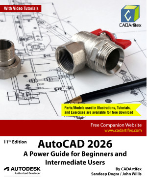
Rubrique : Manuels logiciels / Autocad
AutoCAD 2026: A Power Guide for Beginners and Intermediate Users textbook is designed for instructor-led courses and self-paced learning. It is intended to help engineers, designers, and CAD operators interested in learning AutoCAD to create 2D engineering drawings and 3D Models. This textbook is a great help for new AutoCAD users and a great teaching aid for classroom training. The textbook consists of 13 chapters, and a total of 552 pages covering major workspaces of AutoCAD such as Drafting & Annotation and 3D Modeling, teaching you to use AutoCAD software for creating, editing, plotting, and managing real-world 2D engineering drawings and 3D Models.
This textbook not only focuses on the usage of the tools/commands of AutoCAD but also the concept of design. Every chapter of this textbook contains tutorials that provide users with step-by-step instructions on how to easily create mechanical designs and drawings. Additionally, each chapter ends with a hands-on ... Lire la suite
Rubrique : Manuels logiciels / QGIS
You already know that Geographic Information Systems are about much more than geography.
GIS encompasses all of STEM (Science, Technology, Engineering, and Math) and adds the Arts (STEAM).
GIS offers your students an interdisciplinary approach to learning that unites computer technology, computer assisted design, digital design, and analytic problem solving.
On the Way with GIS builds on the introduction to GIS, established in Open the Door to GIS, featuring more advanced topics. Students will strengthen their skills and increase their confidence in a digital environment, while you guide and support them with pedagogy, not technical expertise.
On the Way with GIS inspires students to construct inquiry based learning techniques, developing transferable skills, by using applications of GIS in a variety of scenarios. Don’t just teach your students how to use GIS, encourage your students to learn how to be part of the global ... Lire la suite
Rubrique : Manuels logiciels / QGIS
Geographic Information Systems are a compelling way to present data as well as offering a learning platform for students to become proficient with a variety of digital, graphical, analytical and technical skills.
Open the Door to GIS offers a way for teachers to use this powerful software in their classes without having to become experts, with freely downloadable Open-Source GIS, QGIS.
Using one of the oldest forms of teaching in the world, storytelling, each chapter offer students a fun and engaging way to learn about GIS, with a weekly story and activity, covering one semester. Students will work with different characters in each chapter to fulfill a task such as going on a treasure hunt, making a 3D map and creating a computer game. Students are supported throughout with easy to follow instructions that encourage their creativity and reflection.
Open the Door to GIS is recommended for students age 10 to 15 years and is available as both ... Lire la suite
Rubrique : Développement outils
Learn to create, index and query spatial databases using SQL that applies to PostgreSQL/PostGIS and more.
What is Spatial SQL?
Learn how to use Spatial SQL to analyze and manipulate geographic data. This book covers everything from basic spatial queries to advanced spatial analysis techniques all using SQL. Even if you don't know how SQL, this book starts from the beginning all the way to advanced queries.
Rubrique : Développement outils
Capabilities of Web GIS keep expanding, and Getting to Know Web GIS, fifth edition, describes some of the most cutting-edge and exciting innovations. From publishing data as services and configuring engaging web and mobile apps to automation, scripting, and real-world applications, this book shares how to use the most current software and apps for using ArcGIS in the cloud.
In the newest edition of Getting to Know Web GIS, you can work with the latest releases of ArcGIS Online, ArcGIS Pro, ArcGIS StoryMaps, and ArcGIS mobile apps. You can experience ArcGIS Experience Builder, ArcGIS Field Maps, ArcGIS Instant Apps, ArcGIS Image for ArcGIS Online, ArcGIS Mission, and the latest advances in artificial intelligence, virtual reality, and tools for spatial data science. No programming is required, but you can learn more about Web GIS programming in this book using JavaScript, webhooks, and ArcGIS Arcade.
Use the fifth edition to
Improve ... Lire la suite
Rubrique : Manuels logiciels / QGIS
Learn how to use QGIS 3 to take your cartographic products to the highest level.
QGIS 3.4 opens up exciting new possibilities for creating beautiful and compelling maps!
Building on the first edition, the authors take you step-by-step through the process of using the latest map design tools and techniques in QGIS 3. With numerous new map designs and completely overhauled workflows, this second edition brings you up to speed with current cartographic technology and trends.
See how QGIS continues to surpass the cartographic capabilities of other geoware available today with its data-driven overrides, flexible expression functions, multitudinous color tools, blend modes, and atlasing capabilities. A prior familiarity with basic QGIS capabilities is assumed. All example data and project files are included.
Written by two of the leading experts in the realm of open source mapping, Anita and Gretchen are experienced authors who ... Lire la suite
Rubrique : Développement outils
Cook up dynamic web maps using the recipes in the Leaflet Cookbook.
Leaflet Cookbook will guide you in getting started with Leaflet, the leading open-source JavaScript library for creating interactive maps. You'll move swiftly along from the basics to creating interesting and dynamic web maps.
Even if you aren't an HTML/CSS wizard, this book will get you up to speed in creating dynamic and sophisticated web maps. With sample code and complete examples, you'll find it easy to create your own maps in no time.
A download package containing all the code and data used in the book is available so you can follow along as well as use the code as a starting point for your own web maps.
Rubrique : Développement outils
Geospatial analysis is used in almost every domain you can think of, including defense, farming, and even medicine. In this special 10th anniversary edition, you'll embark on an exhilarating geospatial analysis adventure using Python. This fourth edition starts with the fundamental concepts, enhancing your expertise in geospatial analysis processes with the help of illustrations, basic formulas, and pseudocode for real-world applications. As you progress, you’ll explore the vast and intricate geospatial technology ecosystem, featuring thousands of software libraries and packages, each offering unique capabilities and insights. This book also explores practical Python GIS geospatial applications, remote sensing data, elevation data, and the dynamic world of geospatial modeling. It emphasizes the predictive and decision-making potential of geospatial technology, allowing you to visualize complex natural world concepts, such as environmental conservation, urban planning, and disaster ... Lire la suite
Geospatial analysis is used in almost every domain you can think of, including defense, farming, and even medicine. In this special 10th anniversary edition, you'll embark on an exhilarating geospatial analysis adventure using Python. This fourth edition starts with the fundamental concepts, enhancing your expertise in geospatial analysis processes with the help of illustrations, basic formulas, and pseudocode for real-world applications. As you progress, you’ll explore the vast and intricate geospatial technology ecosystem, featuring thousands of software libraries and packages, each offering unique capabilities and insights. This book also explores practical Python GIS geospatial applications, remote sensing data, elevation data, and the dynamic world of geospatial modeling. It emphasizes the predictive and decision-making potential of geospatial technology, allowing you to visualize complex natural world concepts, such as environmental conservation, urban planning, and disaster ... Lire la suite
Rubrique : Manuels logiciels / QGIS
Get started with QGIS with this introduction covering everything needed to get you going using free and open source GIS software.
This QGIS tutorial, based on the 3.16 LTR version, introduces you to major concepts and techniques to get you started with viewing data, analysis, and creating maps and reports.
With this book you'll learn about:
The QGIS interface
Creating, analyzing, and editing vector data
Working with raster (image) data
Using plugins
The QGIS Processing Toolbox
Georeferencing
Creating map and reports
Resources for further help and study
The book includes a link to all the data you'll need to follow along with each chapter.
Rubrique : Manuels logiciels / QGIS
Explore the latest Long Term Release (LTR) of QGIS with Discover QGIS 3.x!
A comprehensive updated workbook built for both the classroom and professionals looking to build their skills.
This second edition is a major update to the original Discover QGIS 3.x title published in 2019. Since 2019, there have been 10 new QGIS releases, three of which were long-term releases. It is designed to be used in a classroom setting or by GIS professionals looking to build their skills.
It introduces the QGIS interface and covers: basic GIS concepts, spatial analysis, modeling, data creation and editing, cartographic design and data visualization.
With improved processing, streamlined workflows, support for point cloud data, development of the Temporal Controller, and improved symbology options, it is an exciting time to be learning QGIS!
The improvements in QGIS 3.x allows this Second Edition of Discover QGIS 3.x to be ... Lire la suite
Rubrique : Manuels logiciels / QGIS
Learn to master the Mergin Maps platform to collect, share and manage your field data.
What is Mergin Maps?
Take your QGIS project into the field with Mergin Maps. With Mergin Maps, you can easily capture features and photos with your team, synchronize changes across devices and use the power of QGIS to manage your project.
Rubrique : Développement outils
Everyone loves power tools. The GDAL and OGR utilities are the power tools of the GIS world, and best of all, they're free.
The Geospatial Data Abstraction Library (GDAL), including its subproject OGR, is the preeminent open source data access library that provides GIS commands and tools. It is used behind most of the open source geospatial applications and also sits behind many of the leading proprietary GIS applications on the market today. Along with the programming libraries come several powerful command line utilities, intended to be run by being typed into a terminal or command prompt window.
The utilities include tools for examining, converting, transforming, building and analysing data. This book is a collection of the GDAL and OGR documentation, but also includes substantial new content designed to help guide you in using the utilities to solve your current data problems.
Inside you'll find a quick reference for looking up the ... Lire la suite
Rubrique : Manuels logiciels
Remotely sensed data, in the form of digital images captured from spaceborne and airborne platforms, provide a rich analytical and observational source of information about the current status, as well as changes occurring in, on, and around the Earth’s surface. The data products, or simply images processed from these platforms, provide an additional advantage in that geographic areas or regions of interest can be revisited on a regular cycle. This revisit cycle allows geospatial analysts and natural resource managers to explore changing conditions over time.
Image Processing and Data Analysis with ERDAS IMAGINE® explains the principles behind the processing of remotely sensed data in a simple, easy to understand, and "how-to" format. Organized as a step-by-step guide with exercises adapted from original research and using publicly available imagery, such as NASA Landsat, ESA Sentinel-2, Orthophotos, and others, this book gives readers the ability to quickly gain the ... Lire la suite
Rubrique : Développement outils
What is pgRouting? It's a PostgreSQL extension for developing network routing applications and doing graph analysis.
Interested in pgRouting? If so, chances are you already use PostGIS, the spatial extender for the PostgreSQL database management system. So when you've got PostGIS, why do you need pgRouting? PostGIS is a great tool for molding geometries and doing proximity analysis, however it falls short when your proximity analysis involves constrained paths such as driving along a road or biking along defined paths.
PostGIS alone can't help you apply costs and resource constraints to your travels, such as traffic congestion, mileage restrictions, or allocating resources like vehicles. pgRouting is a complement to PostGIS that allows you to incorporate costs and path restrictions to your proximity analysis.
pgRouting is well suited to building travel navigation systems and computing driving distance polygons for places of interest. While ... Lire la suite
Rubrique : Métiers de la géomatique
Get up to speed quickly on the core topics and career paths that open source GIS has to offer.
What is Open Source GIS?
Are you new to open source software and how it can be applied to GIS? Avoid the guesswork and learn from the decades of experience that Mark brings to the table in How to Succeed as a GIS Rebel. This new book is definitely a departure from the typical Locate Press technical focus but is still very much geared toward the technical concepts of geospatial topics. Instead, Mark leads you through the common concepts of GIS, how he discovered open source GIS, and how he took the initiative to apply it to his career and professional development.
The Technology & the Skills
So many books only talk about the technology of GIS, this one looks at the more personal side of the equation. How do you build knowledge without experience? By learning from the mistakes of others and adopting new tools and techniques.
Mark's ... Lire la suite
Rubrique : Manuels logiciels / QGIS
Desktop Geographic Information System (GIS) software gives you the ability to make maps and analyze geographic information. This book provides a foundational level of knowledge for understanding GIS and the open source desktop mapping applications that are available for use, for free, today.
Learn about vector and raster data, how to convert data, interacting with spatial databases, creating new map data, geoprocessing, scripting, and more. Special sections include focused learning on the Quantum GIS and GRASS GIS software platforms but other packages are also introduced. The Geospatial Desktop is written by the founder of Quantum GIS, so you can rest assured that you will be led by one of the most knowledgeable authors on the subject.
Locate Press is proud to bring this work back into print by releasing this updated edition. Originally known as Desktop GIS: Mapping the Planet with Open Source Tools, this popular book quickly sold out and was out of print ... Lire la suite
Rubrique : Manuels logiciels / QGIS
Bienvenue dans le monde de PyQGIS, le mixage de QGIS et de Python pour étendre et améliorer votre boîte à outils SIG source libre. Avec PyQGIS, vous pouvez éditer des scripts et des plugins pour mettre en œuvre de nouvelles fonctionnalités et effectuer des tâches automatisées.
Ce livre est mis à jour pour fonctionner avec la nouvelle génération de QGIS - version 3.x. Après une brève introduction à Python 3, vous apprendrez à comprendre l'interface du programmeur d'application (API) de QGIS, à écrire des scripts et à construire un plugin.
Ce livre est conçu pour vous permettre de travailler sur les exemples au fur et à mesure. À la fin de chaque chapitre, vous trouverez une série d'exercices que vous pouvez faire pour améliorer votre expérience d'apprentissage.
Le PyQGIS Programmer's Guide est compatible avec la version 3.0 de l'API publiée avec QGIS 3.x.
Rubrique : Développement outils
Discover how to transform geospatial data into stunning, informative maps with Python—the ultimate programming language for GIS professionals and enthusiasts alike.
Whether you’re new to GIS or looking to enhance your Python skills, this book takes you on a journey through geospatial concepts, culminating in the creation of compelling, shareable visualizations.
Maps are the heart of this book. From the very first chapter, you’ll see how Python enables you to go beyond static desktop GIS tools, offering unparalleled flexibility, reusability, and integration with the broader data science ecosystem. Whether you’re managing spatial data pipelines, integrating GIS with machine learning workflows, or simply crafting eye-catching maps, Python is the tool that connects it all.
With this book, you’ll master GIS fundamentals and dive into the world of geospatial data manipulation and analysis. You’ll learn to reproject datasets, perform ... Lire la suite
Rubrique : Manuels logiciels / QGIS
Now updated - learn even more GIS skills for catchment hydrology and water management with QGIS!
This second edition workbook introduces hydrological topics to professionals in the water sector using state of the art functionality in QGIS. The book is also useful as a beginner’s course in GIS concepts, using in a problem-based learning approach.
Designed to take advantage of the latest QGIS features, this book will guide you in improving your maps and analysis.
Rubrique : Manuels logiciels / Autocad
With engineering projects getting bigger, deadlines getting tighter, and greater demands for precision, you need tools that do more and work smarter. Autodesk Civil 3D 2026 rises to the challenge, delivering powerful new capabilities for high-precision design modeling and streamlined collaboration. In this second edition, Stephen Walz and Tony Sabat, leaders in digital design and innovation in civil infrastructure, walk you through Civil 3D’s cutting-edge features, such as pressure layout improvements, dynamic corridor targeting, and performance enhancements for surface modeling and grading. It’s not just about learning new features; you’ll be able to integrate these new toolsets into real-world workflows, develop standards, and collaborate effectively within distributed teams. From surface development and intelligent utility design to smart document creation, this book explores practical and automated applications of tools and modeling techniques that you’ll use every day. ... Lire la suite
With engineering projects getting bigger, deadlines getting tighter, and greater demands for precision, you need tools that do more and work smarter. Autodesk Civil 3D 2026 rises to the challenge, delivering powerful new capabilities for high-precision design modeling and streamlined collaboration. In this second edition, Stephen Walz and Tony Sabat, leaders in digital design and innovation in civil infrastructure, walk you through Civil 3D’s cutting-edge features, such as pressure layout improvements, dynamic corridor targeting, and performance enhancements for surface modeling and grading. It’s not just about learning new features; you’ll be able to integrate these new toolsets into real-world workflows, develop standards, and collaborate effectively within distributed teams. From surface development and intelligent utility design to smart document creation, this book explores practical and automated applications of tools and modeling techniques that you’ll use every day. ... Lire la suite
Rubrique : Manuels logiciels / Esri
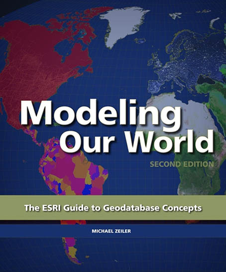
Modeling Our World presents a complete survey of the geodatabase information model. This book explains how to use geodatabase structural elements to promote best practices for data modeling and powerful geographic analyses; how to use rules and data properties in the geodatabase to ensure spatial and attribute integrity; how to manage your organization’s workflow; and how to scale geodatabases from small projects up to multiple departments across a large organization.
Modeling Our World presents a complete survey of the geodatabase information model. This book explains how to use geodatabase structural elements to promote best practices for data modeling and powerful geographic analyses; how to use rules and data properties in the geodatabase to ensure spatial and attribute integrity; how to manage your organization’s workflow; and how to scale geodatabases from small projects up to multiple departments across a large organization.
Année : 2010
Editeur : Esri Press
Url : https://www.esri.com/en-us/esri-press/browse/modeling-our-wo ...
27-01-2026
Rubrique : Cartographie
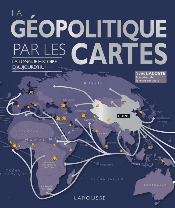
Un ouvrage percutant, rigoureux et vivant pour comprendre ce qui se joue et se décide derrière les conflits d’aujourd’hui.
Dans cette nouvelle édition revue et actualisée, l’auteur propose une approche originale
des grands enjeux de notre temps, en les reliant les uns aux autres à travers la superposition de cartes de différentes régions, du plan local au plan mondial, et réciproquement.
Comment la Chine est-elle devenue la seconde puissance mondiale ? Comment peuvent évoluer les relations entre les États-Unis et les pays du Moyen-Orient ? L’Europe des 27 est-elle un ensemble géopolitique majeur ? La Russie peut-elle espérer reconquérir son statut d’empire ?… Chacune de ces situations est éclaircie, commentée, analysée au regard d’une évolution dans le temps. Le lecteur peut ainsi mieux comprendre les intérêts, les points de vue et les réactions des peuples de tous ces pays et de leurs dirigeants.
Année : 2022
Editeur : Larousse
Url : https://www.editions-larousse.fr/livre/la-geopolitique-par-l ...