Nous utilisons des cookies pour vous garantir la meilleure expérience sur notre site. Si vous continuez à utiliser ce dernier, nous considèrerons que vous acceptez l'utilisation des cookies. J'ai compris ! ou En savoir plus !.
banniere

Le portail francophone de la géomatique


Toujours pas inscrit ? Mot de passe oublié ?

LivreESRI - Getting to Know Arcview Gis: The Geographic Information System (Gis) for Everyone
Cliquer pour agrandir
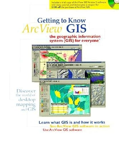
From the Introduction: Move over text files, move over spreadsheets, and databases: geographic information systems have arrived on the desktop. Geographic information systems (GIS) let you visualize information in new ways that reveal relationships, patterns, and trends not visible with other popular systems.

Getting to Know ArcView GIS presents the concepts upon which this technology is based, how it works, and what it does. In part 1 of the book, you'll see how people in a wide range of fields are using desktop GIS to find potential customers, locate the best place for a new business or facility, identify natural areas needing protection, find the best places to develop real estate, manage extensive road networks, inventory forest lands, do emergency planning in urban areas, manage resources after fire and flood--the list goes on and on. You'll find out how you can use desktop GIS to study and analyze situations and create high-quality maps and charts. You also get ... Lire la suite

LivreHOHL P., MAYO B. - Arcview Gis Exercise Book
Cliquer pour agrandir
Although in general the exercise build on skills gained in previous
chapters, any of the exercises could readily be used on their
own to learn a particular ArcView functionality. It could be
equally useful as a reference book…Worthwhile Tips, Notes, and
Warnings are also scattered through the book. The prepared
project files on the CD make it very easy to do
the exercises quickly and easily, plus the results are included
on the CD in case you get stuck.

I would highly recommend this book to the ArcView and/or GIS novice.
It seems particularly appropriate for that audience because of the progression of the material, from overview of ArcView components, to working with basic functionality, to much more advanced analysis. Each topic is covered thoroughly for complete understanding of the section, and the user can move through it at their own pace and schedule.

LivreHUTCHINSON S., DANIEL L. - Inside Arcview Gis
Cliquer pour agrandir
Thoughtfully updated based on new ArcView GIS 3.1 and 3.2 functionality, INSIDE ArcView GIS, 3rd Edition, continues to meet the needs of individuals who want to learn to use ArcView GIS "out of the box" to access maps and display geographic information. By consulting detailed examples and working independently through success-proven tutorials, INSIDE ArcView GIS, 3rd Edition, readers will learn to: -Generate business graphics and statistics linked with maps -Work with diverse databases -Customize ArcView GIS -Optimize application design -Produce hardcopy maps As in previous editions, no prior experience is assumed as the authors take readers on a journey through the software's principal functionality, guiding them through development of a single application from start to finish. Examples and exercises drawn from Business, Government, and Education are also located strategically throughout the book to underscore key aspects of ArcView GIS use. The CD-ROM, included with the book, ... Lire la suite

LivreLEE J., WING-SHUN WONG D. - Statistical Analysis With Arcview G I S
Cliquer pour agrandir
Statistical techniques for dealing with quantitative data are important tools for every geographer. This is the first book to bring the traditional tools of quantitative geography into the GIS environment. Up to this point, existing books have relied on older software not widely found in a geography context. This brand new resource teaches professionals and students alike how to use their software in applying established statistical techniques.

LivreMADEJ E. - Cartographic Design Using Arcview Gis
Cliquer pour agrandir
Covering ArcView GIS mapmaking functionality, this book teaches you the principles of cartographic design, and how to apply them to produce high-quality maps ideally suited to your audience, whether in print or on the web. Learn how to get the most out of your geographic data with ArcView's basic tools, while exploring powerful extensions that help you place type quickly, create custom symbols and colors, and make attractive and understandable map layouts. The book explores mapmaking in the context of GIS/ArcView capabilities, including how maps function best; working with data sources; manipulating, maximizing, and sharing data; the power of layering; producing maps for presentations, print, and the Internet; and much more. Cartographic Design Using ArcViewÒ GIS combines the power of GIS technology with the art of graphic design to help make your mapmaking a success.

LivreORMSBY T., ALVI J. - Extending Arcview Gis : Teach Yourself to Use Arcview Gis Extensions
Cliquer pour agrandir
Extending ArcView GIS is the companion workbook to ESRI's best-selling Getting to Know ArcView GIS. Taking up where that book leaves off, it explores the three most popular ESRI ArcView GIS extensions - ArcView Network Analyst, ArcView Spatial Analyst, and ArcView 3D Analyst. You'll complete dozens of step-by-step exercises in the course of solving a variety of GIS problems. Concepts are presented concisely and in context, while color graphics reinforce your progress at every stage.

The exercises in this book require that you have ArcView GIS 3.1 software. To complete each of the three sections, you'll also need the appropriate extension software - ArcView Network Analyst 1.0b for the Network Analyst section, ArcView Spatial Analyst 1.1 for the ArcView Spatial Analyst section, and ArcView 3D Analyst 1 for the 3D Analyst section. Each section is self-contained and uses only the extension software it describes. The accompanying CD contains 90 megabytes of spatial data ... Lire la suite

LivreRAZAVI A-H. - Arcview Gis Developer's Guide: Programming With Avenue
Cliquer pour agrandir
ArcView GIS Developer's Guide offers readers one of the most complete and widely used introductions to Avenue, ESRI's proprietary programming language for ArcView GIS, available anywhere. Newly updated and written to ArcView GIS 3.2a, this edition begins with an explanation of the object-oriented programming concept. From this starting point, readers proceed directly into practical demonstrations, examples of programming code, and tutorials engineered to lead them through the steps required to customize the ArcView GIS interface; create, edit, and test scripts; produce hardcopy maps; and integrate ArcView GIS with other applications. Coverage of Avenue fundamentals meets the needs of the novice, while individual chapters on Dialog Designer and programming Spatial Analyst benefit even the most experienced programmer. Familiarity with GIS as a data visualization tool is assumed, yet no prior programming experience is required to use this combination how-to and reference manual as a ... Lire la suite

LivreRAZAVI A-H. - Arcview Gis/Avenue Developer's Guide
Cliquer pour agrandir
The audience of the book is anyone interested in programming in Avenue
who wants more than the documentation shipped with Arc/View...
In addition to the focus on application development and the digital
code on disk, there are enough differences in style and content
between ArcView GIS/Avenue Developers Guide and the ESRI documentation
that make this book a valuable addition to your Avenue
arsenal.

LivreRAZAVI A-H., WARWICK V. - Arcview Gis/Avenue Programmer's Reference: Class Hierarchy Quick Reference and 100+ Scripts
Cliquer pour agrandir
Now in a successful third edition, and fully updated based on ArcView GIS Version 3.1, the ArcView GIS/Avenue Programmer's Reference provides intermediate and advanced ArcView GIS users with one of the most complete sources of information on Avenue, the programming language of ArcView GIS. Included are more than 200 Avenue classes and 101 ready-to-use Avenue scripts, organized for optimum accessibility. Script management, graphical user interface management, and project production documentation are also covered in this comprehensive volume. A class hierarchy reference provides a summary of classes, class requests, instance requests, and enumeration. Also, avenue scripts enable readers to accomplish a variety of common customization tasks, while encouraging experimentation

LivreWILPEN GORR, KRISTEN S. KURLAND - Gis Tutorial: Arcview 9
Cliquer pour agrandir