Vous pouvez lire le billet sur le blog La Minute pour plus d'informations sur les RSS !
Canaux
4770 éléments (3 non lus) dans 55 canaux
 Du côté des éditeurs
(1 non lus)
 Toile géomatique francophone
(2 non lus)
 Géomatique anglophone
-
sur Le blog de Geomatys: 2024 chez Geomatys
Publié: 23 December 2024, 11:23am CET
 2024 chez Geomatys
- 23/12/2024
- Jordan Serviere
Alors que 2024 s’achève, Geomatys se distingue une fois de plus comme un acteur clé dans le domaine de l’information géospatiale, des systèmes d’information environnementale et de la défense. Cette année a été marquée par des avancées technologiques concrètes, des reconnaissances importantes et des collaborations stratégiques qui ont renforcé notre position dans des secteurs en constante évolution. Retour sur ces douze mois faits de projets ambitieux et de réalisations collectives.
Examind C2 : réinvention de la gestion tactiqueLe lancement d’Examind C2 représente une étape cruciale en 2024, tant pour Geomatys que pour les secteurs de la défense, de la cybersécurité et de la gestion de crise. Cette plateforme de Commande et Contrôle (C2), conçue pour répondre aux besoins complexes des environnements multi-milieux et multi-champs, se distingue par son interopérabilité avancée et son traitement en quasi-temps réel. Les visualisations dynamiques qu’elle propose offrent une supériorité informationnelle essentielle pour optimiser les prises de décision dans des situations critiques. Avec des capacités étendues en traitement de données spatiales, Examind C2 anticipe également les attentes futures des utilisateurs. Pour une analyse approfondie de ses capacités et de ses cas d’utilisation, rendez-vous sur le site officiel.
AQUALIT : vers une gestion durable de l’eau potableEn 2024, Geomatys a franchi une nouvelle étape avec la commercialisation d’AQUALIT, une plateforme novatrice destinée à l’analyse des mesures d’eau. Conçue spécifiquement pour les producteurs d’eau potable, AQUALIT leur fournit des outils puissants pour surveiller, analyser et optimiser la qualité de leurs ressources. Cette solution intègre des fonctionnalités avancées en gestion des données hydrologiques, en analyse prédictive et en visualisation cartographique. Dans un contexte où la gestion durable de l’eau est devenue un enjeu prioritaire, AQUALIT illustre parfaitement l’engagement de Geomatys en faveur de l’environnement et de l’innovation. Pour en savoir plus et découvrir toutes ses fonctionnalités, consultez le site d’AQUALIT.
OPAT devient ShoreInt : une évolution pour mieux répondre aux besoins côtiersEn 2024, notre projet OPAT a connu une évolution majeure en devenant ShoreInt. Cette transition reflète notre désir d’offrir une solution toujours plus adaptée aux enjeux complexes de la gestion des zones côtières. ShoreInt intègre des données issues de technologies comme l’AIS, les images satellites et la modélisation spatiale pour fournir une analyse précise des activités maritimes et des dynamiques environnementales. Avec une interface ergonomique et des outils avancés de visualisation, ShoreInt est conçu pour aider les décisionnaires à gérer les interactions complexes entre les activités humaines et les écosystèmes côtiers. Pour en savoir plus sur cette solution innovante, consultez le site de ShoreInt.
Lauréat du Concours d’innovation avec EpiwiseUn des temps forts de 2024 est sans conteste la distinction obtenue par Geomatys pour son projet Epiwise lors des Concours d’innovation de l’État. Soutenu par France 2030, ce projet épidémiologique figure parmi les 177 initiatives lauréates reconnues pour leur potentiel à transformer durablement leur secteur. Cette récompense reflète notre capacité à innover tout en répondant à des besoins sociétaux majeurs, tels que la prévention des pandémies et la modélisation épidémiologique. En s’appuyant sur des technologies de machine learning et de traitement des big data, Epiwise offre des perspectives nouvelles pour la santé publique.
Collaboration et continuité : une stratégie collectiveAu-delà de ces projets phares, Geomatys a maintenu en 2024 un rythme soutenu de collaboration dans des initiatives d’envergure. Parmi elles, FairEase, le portail Géosud et nos partenariats stratégiques avec Mercator Ocean et l’Office Français de la Biodiversité. Ces travaux, axés sur la valorisation des données spatiales, l’interopérabilité et la gestion des ressources naturelles, témoignent de notre engagement à développer des solutions ouvertes, accessibles et adaptées aux enjeux environnementaux contemporains. Ces projets, loin de s’arrêter en 2024, constituent un socle solide pour notre développement en 2025 et au-delà.
Et en 2025...Alors que nous nous tournons vers 2025, Geomatys se prépare à renforcer son impact et à ouvrir de nouvelles perspectives. En poursuivant nos investissements dans la recherche et le développement, notamment en télédétection, modélisation environnementale et gestion des données massives, nous ambitionnons de créer des solutions toujours plus performantes et adaptées aux besoins d’un monde en mutation rapide. L’année à venir sera marquée par le renforcement de nos relations avec nos partenaires stratégiques, dans une perspective de collaboration continue et durable. Nous adressons nos sincères remerciements à nos collaborateurs, dont l’engagement et les compétences sont le moteur de nos réussites, ainsi qu’à nos clients et partenaires pour leur soutien indéfectible. Ensemble, faisons de 2025 une année riche en projets et accomplissements. Toute l’équipe vous souhaite de très belles fêtes de fin d’année. Rendez-vous en 2025 !
Menu Linkedin
Twitter
Youtube

The post 2024 chez Geomatys first appeared on Geomatys.
-
sur Mapping Marine Traffic
Publié: 23 December 2024, 10:10am CET par Keir Clarke
Esri's interactive map U.S. Vessel Traffic offers a captivating visualization of activity on U.S. waterways, underscoring the vital role marine traffic plays in commerce, travel, and environmental management. Over the past decade, vessel traffic in the U.S. has seen significant growth, with annual cargo shipments reaching 2.3 billion tons.Esri's interactive map leverages Automatic
-
sur PostGIS Development: PostGIS Patch Releases
Publié: 23 December 2024, 1:00am CET
-
sur Mappery: Candy Jar
Publié: 22 December 2024, 11:00am CET

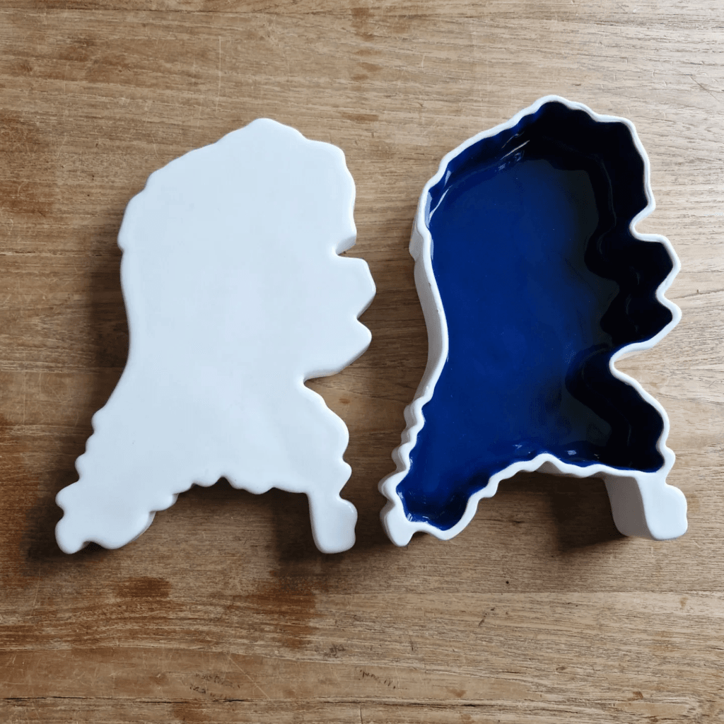
Koen Rutten shared this candy jar.
“#mapsInTheWild My new candy jar! Made by Royal Goedewaagen to the design of Sander Alblas. In my case: a second-hand one.”
-
sur The Taco Bell Interstate Map
Publié: 21 December 2024, 11:29am CET par Keir Clarke
If you insist on only eating at a Taco Bell while driving cross-country then you need Think Outside the Bun. Think Outside the Bus is an interactive map of Taco Bell locations across the United States. For Taco Bell enthusiasts, this map is an invaluable tool, showing which states, cities, and even interstates offer the best access to affordable Mexican-inspired cuisine.The map uses the size of
-
sur Mappery: From the Heart
Publié: 21 December 2024, 11:00am CET
Pièce jointe: [télécharger]

Another map shared by Le Cartographe during a trip to Portugal.
-
sur Moon 2.0
Publié: 20 December 2024, 3:57pm CET par Keir Clarke
NASA is planning a crewed Moon landing in 2027, while the China National Space Administration (CNSA) aims to land astronauts on the Moon by 2030. India, too, has announced plans to send a person to the Moon by 2040.This renewed interest in our closest celestial neighbor suggests that the lunar surface will soon be home to even more human-made objects. Currently, nearly 1,000 items from Earth
-
sur Mappery: How far have you flown from Tartu
Publié: 20 December 2024, 11:00am CET

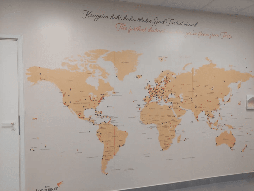
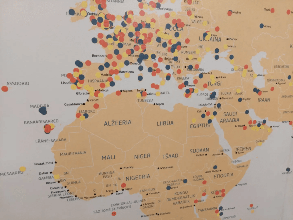
Ivan Sanchez Ortega spottted this big wall map in Tartu airport. People have placed coloured dots representing the furthest distance they have flown from Tartu. Not sure if the colours have added significance.
-
sur TorchGeo: v0.6.2
Publié: 20 December 2024, 12:22am CET
TorchGeo 0.6.2 Release NotesThis is a bugfix release. There are no new features or API changes with respect to the 0.6.1 release.
This release doubles the number of TorchGeo tutorials, making it easier than ever to learn TorchGeo! All tutorials have been reorganized as follows:
- Getting Started: background material on PyTorch, geospatial data, and TorchGeo
- Basic Usage: basic concepts and components of TorchGeo and how to use them
- Case Studies: end-to-end workflows for common remote sensing use cases
- Customization: customizing TorchGeo to meet your needs, and contributing back those changes
If you have a use case that is not yet documented, please consider contributing a new Case Study tutorial!
Dependencies Datasets- Chesapeake 7/13: remove references to removed classes (#2388)
- Chesapeake CVPR: fix download link (#2445)
- EuroSAT: fix order of Sentinel-2 bands (#2480)
- EuroSAT: redistribute split files on Hugging Face (#2432)
- Forest Damage: fix _verify docstring (#2401)
- Million-AID: fix _verify docstring (#2401)
- UC Merced: redistribute split files on Hugging Face (#2433)
- Utilities: remove defaultdict from collation functions (#2398)
- Add
bandsmetadata to all pre-trained weights (#2376)
- SSL4EO: Sentinel-2 name changed on GEE (#2421)
- CI: more human-readable cache names (#2426)
- Models: test that
bandsmatch expected dimensions (#2383)
- Docs: update alternatives (#2437)
- Docs: reorganize tutorial hierarchy (#2439)
- Add Introduction to PyTorch tutorial (#2440, #2467)
- Add Introduction to Geospatial Data tutorial (#2446, #2467)
- Add Introduction to TorchGeo tutorial (#2457)
- Add TorchGeo CLI tutorial (#2479)
- Add Earth Surface Water tutorial (#960)
- Add contribution tutorial for Non-Geo Datasets (#2451, #2469)
- Add contribution tutorial for Data Modules (#2452)
- Add consistent author and copyright info to all tutorials (#2478)
- Update tutorial for transforms and pretrained weights (#2454)
- README: correct syntax highlighting for console code (#2482)
- README: root -> paths for GeoDatasets (#2438)
This release is thanks to the following contributors:
@adamjstewart
@calebrob6
@cordmaur
@giswqs
@hfangcat
@InderParmar
@lhackel-tub
@nilsleh
@yichiac -
sur GeoTools Team: GeoTools 31.5
Publié: 19 December 2024, 11:09am CET
GeoTools 31.5 released The GeoTools team is pleased to announce the release of the latest maintenance version of GeoTools 31.5: geotools-31.5-bin.zip geotools-31.5-doc.zip geotools-31.5-userguide.zip geotools-31.5-project.zip This release is also available from the OSGeo Maven Repository and is made in conjunction with GeoServer
-
sur The Coldest Day of the Year
Publié: 19 December 2024, 11:04am CET par Keir Clarke
Did you know the coldest day of the year doesn’t arrive at the same time for everyone in the U.S.? While Groveland, California, is shivering through its chilliest day today, parts of the East Coast are still weeks away from their coldest temperatures. This is because the coldest day of the year, on average, occurs at least a month earlier on the western seaboard than on the eastern seaboard of
-
sur Mappery: Nobody Is Illegal
Publié: 19 December 2024, 11:00am CET
-
sur KAN T&IT Blog: GeoNode Cloud: Presentación oficial
Publié: 18 December 2024, 4:43pm CET
 ¡Ha llegado el momento! Presentamos GeoNode Cloud, la plataforma en la nube que transforma la gestión de datos geoespaciales.
 Sin necesidad de infraestructura interna.
 Escalable y confiable gracias a Kubernetes.
 Una solución para todos: comunidad open source, sector privado y gobierno.
 GeoNode Cloud te ayuda a lograr más con menos esfuerzo
 Empezá a explorar: GitHub – Kan-T-IT/geonode-cloud: GeoNode Cloud es una implementación avanzada de la plataforma GeoNode para la nube, integrando Geoserver Cloud para su implementación en Kubernetes.
¿Querés saber más? ¡escribinos! info@kan.com.ar o contestá este posteo#GeoNodeCloud #OpenSource #GeospatialData #CloudComputing #Nube #DatosGeoespaciales #GIS #Cloud #AWS #K8s #Kubernete #digitaltwin #smartcity
Versión en inglés: The time has come! Introducing GeoNode Cloud, the cloud platform that revolutionizes geospatial data management.
 No internal infrastructure needed.
 Scalable and reliable, powered by Kubernetes.
 A solution for everyone: the open-source community, private sector, and government.
 GeoNode Cloud helps you achieve more with less effort.
 Start exploring:GitHub – Kan-T-IT/geonode-cloud: GeoNode Cloud is an advanced implementation of the GeoNode platform for the cloud, integrating Geoserver Cloud for deployment on Kubernetes.
Want to learn more? Write to us at info@kan.com.ar or reply to this post.
#GeoNodeCloud #OpenSource #GeospatialData #CloudComputing #Cloud #Geospatial #GIS #AWS #K8s #Kubernetes #DigitalTwin #SmartCity
-
sur An Earth Powered by the Sun
Publié: 18 December 2024, 11:02am CET par Keir Clarke
Australia's ABC has used data from TransitionZero to map out the astonishing growth in solar energy around the world. Using machine learning to analyze global satellite imagery, TransitionZero has discovered that solar farms now cover approximately 19,000 square kilometers of the Earth. And the number of solar installations is doubling every three years.Using a 3D globe of the Earth, ABC has
-
sur Mappery: Global Fire Pit
Publié: 18 December 2024, 11:00am CET
Pièce jointe: [télécharger]

Alfons shared this, he asked “Is this meant to be macabre, cynical or educational?”
-
sur GeoServer Team: GeoServer 2.25.5 Release
Publié: 18 December 2024, 1:00am CET
GeoServer 2.25.5 release is now available with downloads (bin, war, windows), along with docs and extensions.
This is a maintenance release of GeoServer providing existing installations with minor updates and bug fixes. GeoServer 2.25.5 is made in conjunction with GeoTools 31.5, and GeoWebCache 1.25.3. The final release of the 2.25 series is planned for February 2025, please start making plans for an upgrade to 2.26.x or newer.
Thanks to Andrea Aime (GeoSolutions) for making this release.
Release notesImprovement:
- GEOS-11612 Add system property support for Proxy base URL -> use headers activation
- GEOS-11616 GSIP 229 - File system access isolation
- GEOS-11644 Introducing the rest/security/acl/catalog/reload rest endpoint
Bug:
- GEOS-11494 WFS GetFeature request with a propertyname parameter fails when layer attributes are customized (removed or reordered)
- GEOS-11606 geofence-server imports obsolete asm dep
- GEOS-11611 When Extracting the WFS Service Name from the HTTP Request A Slash Before the Question Marks Causes Issues
- GEOS-11643 WCS input read limits can be fooled by geotiff reader
Task:
- GEOS-11609 Bump XStream from 1.4.20 to 1.4.21
- GEOS-11610 Update Jetty from 9.4.55.v20240627 to 9.4.56.v20240826
- GEOS-11631 Update MySQL driver to 9.1.0
For the complete list see 2.25.5 release notes.
Community UpdatesCommunity module development:
- GEOS-11635 Add support for opaque auth tokens in OpenID connect
- GEOS-11637 DGGS min/max resolution settings stop working after restart
Community modules are shared as source code to encourage collaboration. If a topic being explored is of interest to you, please contact the module developer to offer assistance.
About GeoServer 2.25 SeriesAdditional information on GeoServer 2.25 series:
- GeoServer 2.25 User Manual
- GeoServer 2024 Roadmap Plannings
- Raster Attribute Table extension
- Individual contributor clarification
Release notes: ( 2.25.5 | 2.25.4 | 2.25.3 | 2.25.2 | 2.25.1 | 2.25.0 | 2.25-RC )
-
sur The CEO Murder Map
Publié: 17 December 2024, 2:41pm CET par Keir Clarke
For the past two weeks, the United States has been reeling from the shocking murder of Brian Thompson in New York. As a data scientist, my instinct is always to ask how data can help make sense of what, on the surface, appears to be a senseless act of violence.To that end, I have created the CEO Murder Map, to identify potential geographical patterns in the murders of millionaire executives
-
sur OSGeo Announcements: [OSGeo-Announce] pgRouting graduates OSGeo Incubation
Publié: 17 December 2024, 1:25pm CET
OSGeo welcomes pgRouting to its growing ecosystem of projects.
OSGeo is pleased to announce that pgRouting has graduated from incubation and is now a full-fledged OSGeo project.
pgRouting is an open-source extension in the PostGIS / PostgreSQL geospatial database, providing geospatial routing functionality.
Graduating incubation includes fulfilling requirements for open community operation, a responsible project governance model, code provenance, and general good project operation. Graduation is the OSGeo seal of approval for a project and gives potential users and the community at large an added confidence in the viability and safety of the project.
The pgRouitng Steering Committee collectively recognizes this as a big progressive step for the project.
pgRouting has been an active contributor and participant to various open source initiatives inside and outside OSGeo such as FOSS4G, OSGeo Code Sprints, OGC Code Sprints, Joint OSGeo-OGC-ASF (Apache Software Foundation) Code Sprints, and Google Summer of Code.
The pgRouitng PSC says, “We are excited about the future of the project within the OSGeo’s project ecosystem. We have been working to have a community of developers for the project sustainability. It is our honor to be an OSGeo project”.
The pgRouting PSC would like to thank our mentor, Angelos Tzotsos, and the OSGeo Incubation Committee for their assistance during this Incubator process.
Congratulations to the pgRouting community!
About pgRouting
pgRouting extends the PostGIS / PostgreSQL geospatial database to provide geospatial routing functionality. It is written in C++, C and SQL.
It is an open source PostgreSQL extension which implements several graph algorithms.
pgRouting library contains the following features:
- All Pairs Shortest Path algorithms: Floyd-Warshall and Johnson’s Algorithm
- Shortest Path and bi-directional algorithms: Dijkstra, A*
- Graph components, analysis and contraction algorithms.
- Traveling Sales Person
- Graph components, analysis and contraction algorithms.
- Shortest Path with turn restrictions
pgRouting is able to process geospatial and non geospatial graphs.
It’s processing extension execute a number of existing graph algorithms based on reliable software and libraries. It is written in such a way that gives the ability to hook a new graph algorithm in a clean way including the connection code to the database.
The pgRouting functions are standardized in terms of parameter types and names, decreasing the learning curve of a user.
pgRouting is very flexible with graph data input, in an inner SQL query and output with standardized column names, so you can process almost any kind of graph data stored in the database.
About OSGeo
The Open Source Geospatial Foundation is not-for-profit organization to “empower everyone with open source geospatial‘. The software foundation directly supports projects serving as an outreach and advocacy organization providing financial, organizational and legal support for the open source geospatial community.
OSGeo works with Re:Earth, QFieldCloud, GeoCat, T-Kartor, and other sponsors, along with our partners to foster an open approach to software, standards, data, and education.
2 posts - 2 participants
-
sur Mappery: London cap
Publié: 17 December 2024, 11:00am CET



I found these caps in Camden, London. The coordinates point to the well-known Harrods of London.
-
sur Free and Open Source GIS Ramblings: Urban Mobility Insights with MovingPandas & CARTO in Snowflake
Publié: 17 December 2024, 10:59am CET
-
sur The WaterwayMap
Publié: 16 December 2024, 2:59pm CET par Keir Clarke
The WaterwayMap is a visually beautiful interactive map that uses OpenStreetMap data to visualize the structure and flow of rivers around the world.At its core, WaterwayMap utilizes the directional data of waterways recorded in OpenStreetMap (OSM). In OSM, waterways are represented as ways - ordered lists of nodes that indicate the sequence and direction of flow. WWM uses this
-
sur Mappery: Tattoo Shop Decor
Publié: 16 December 2024, 11:00am CET


Erik spotted this sort of thematic map in a tattoo shop in Bratislava. I can’t work out the thematic criteria
“Nice #mapsinthewild in a tattoo shop in Bratislava. [https:]] to be exact. Walking past while on the way to the #QGISUC2024 dinner location. Map with New Zealand, but transformation might be a bit off.”
-
sur Mappery: Toronto Waterfront
Publié: 15 December 2024, 11:00am CET


Clare shared this map of Toronto
-
sur BostonGIS: The bus factor problem
Publié: 15 December 2024, 4:11am CET
One of the biggest problems open source projects face today is the bus factor problem.
I've been thinking a lot about this lately as how it applies to my PostGIS, pgRouting, and OSGeo System Administration (SAC) teams.
Continue reading "The bus factor problem" -
sur Mappery: The New Deal
Publié: 14 December 2024, 11:00am CET
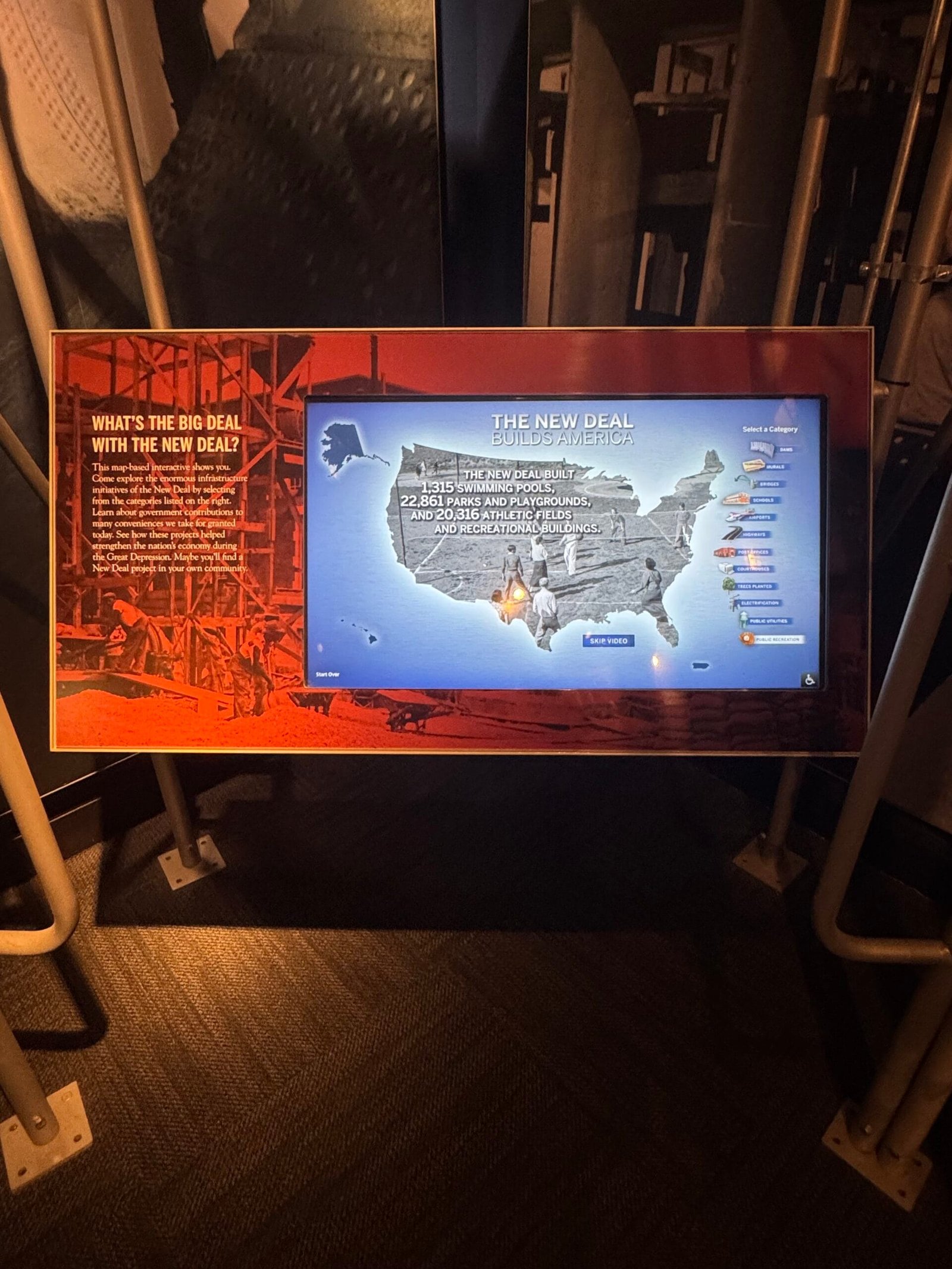
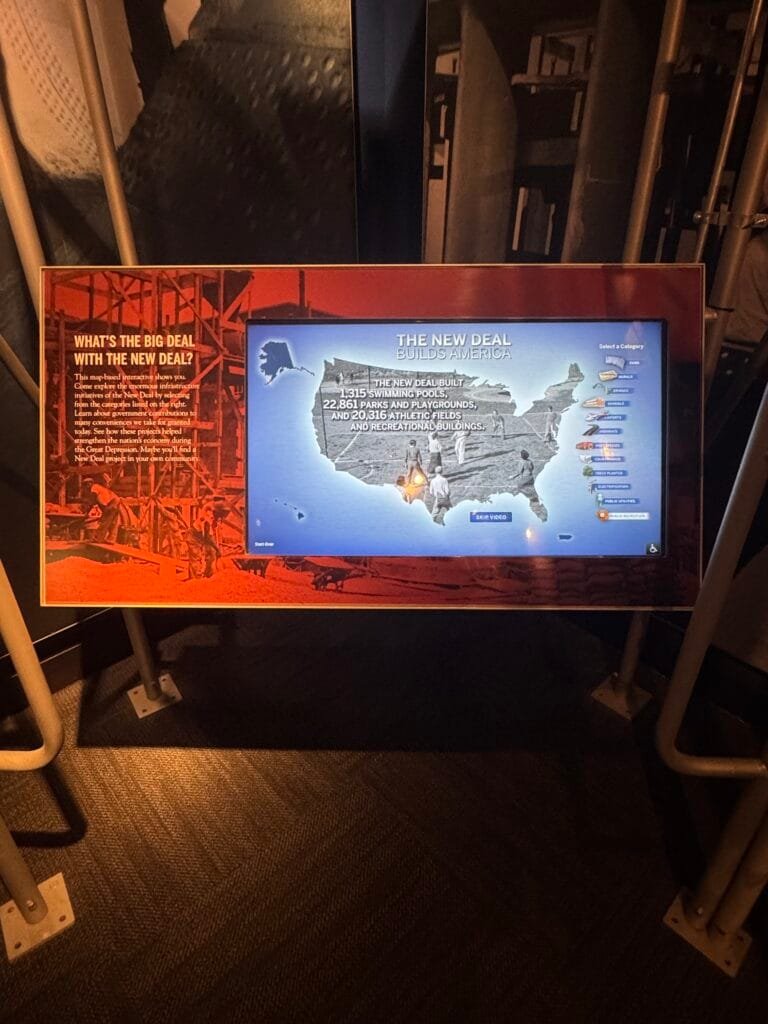
An interactive map from the FDR Museum
“Learn about government contributions to many conveniences we take for granted today. See how these projects helped strengthen the nation’s economy during the Great Depression. Maybe you’ll find a New Deal project in your own community”
-
sur Draw Your Neighborhood
Publié: 14 December 2024, 10:29am CET par Keir Clarke
DETROITography has released an innovative interactive map that allows Detroit residents to outline their neighborhoods based on their personal perceptions. The aim of the Detroit Neighborhoods Mapping Tool is 'to collectively map neighborhoods as an image of the city in maps and words'.The tool starts with a blank base map, devoid of predefined neighborhood names or boundaries. Users are
-
sur QGIS Blog: Plugin Update – November, 2024
Publié: 14 December 2024, 10:24am CET
November was a really productive month, with a remarkable total of 43 new plugins published in QGIS plugin repository. In addition there are 3 more plugins from October listed here, which somehow were missed, and for that we apologize to their authors.
Here follows the quick overview in reverse chronological order. If any of the names or short descriptions catches your attention, you can find the direct link to the plugin page in the table below:
All Geocoders At Once Plugin accumulating most popular geocoders. ODK Connect Connect to ODK Central, fetch submissions, and visualize field data on QGIS maps. Supports filtering, spatial analysis, and data export. Web Service Plugin Wtyczka umo?liwia prezentacj? danych z serwisów WMS, WMTS, WFS i WCS w postaci warstw w QGIS. Wtyczka wykorzystuje dane z Ewidencji Zbiorów i Us?ug oraz strony geoportal.gov.pl Polygon grouper This plugin groups polygons together. GeoCAR Cadastro Ambiental Rural. Not-So-QT-DEM TauDEM 5.3 processing provider. GeocodeCN ????????????????
EN: A plug-in that converts addresses into latitude and longitude coordinates.Feature Navigator Este plugin permite navegar entre entidades en una capa activa de QGIS con botones de anterior y siguiente. Movement Analysis Toolbox for raster based movement analysis: least-cost path, accumulated cost surface, accessibility. Graphab3 Graphab3 for QGIS. SGTool Simple Potential Field Processing. FieldColorCoder Easily apply color codes to layers based on selected field values. NGP Connect Plugin to store files in Lantmäteriet National Geodata Platform with external storage for the attachment widget in features attribute form. Projection Factors Redux Calculates various cartographic projection properties as a raster layer. ArqueoTransectas Este complemento genera transectas arqueológicas (líneas horizontales o verticales) dentro de un área definida. Puede ser útil para estudios de campo y proyectos arqueológicos. BROnodig Plugin om BRO data te downloaden en plotten. Arches Project A plugin that links QGIS to an Arches project. Field annotations Make annotations and photos in the field. qCEPHEE Plugin QGIS for CEPHEE. Water Network Tools for Resilience (WNTR) Integration A QGIS Plugin for the WNTR piped water network modelling package. Allows the preparation of water network models and visualisation of simulation results within QGIS. FitLoader A simple plugin to import FIT files. EasyDEM Get Digital Elevation Model (DEM) datasets from multiple sources with Google Earth Engine API and load it as raster layer. Si Kataster EN: SiKataster is a tool for accessing cadastral parcel data from the Real Estate Cadastre of the Surveying and Mapping Authority of the Republic of Slovenia (GURS). The plugin is designed to record information about the source and the date of data acquisition into the metadata of the layers it creates. The data and web service are provided by GURS.
SI: SiKataster je orodje za dostop do podatkov o parcelah v Katastru nepremi?nin Geodetske uprave Republike Slovenije (GURS). Vti?nik je zasnovan na na?in, da v metapodatke slojev, ki jih ustvari, zapiše informacije o viru in datumu prevzema podatkov. Podatke in spletni servis zagotavlja GURS.Shred Layer Plugin This plugin allows users to “shred” a layer. Can be used to delete unnecessary layers or when you do not want to leave evidence. Cut layers can also be scattered on the map. otsusmethod This plugin applies Otsu’s method for automated thresholding and segmentation of raster data. Split Lines By Points Split Lines By Points. ??????? ???????????
EN: A collection of functions to implement graphics processingEasy Feature Selector The Easy Feature Selector plugin for QGIS is a practical tool designed to simplify interactions with vector data. GenSimPlot Generator of simulation plots. LockCanvasZoom The Lock and Unlock Canvas Zoom Plugin for QGIS is designed to provide users with a simple way to lock and unlock the zoom position on the map canvas. This plugin offers a toggle button that allows users to easily switch between locked and unlocked states for the map canvas zoom. GWAT – Watershed Analysis Toolbox by Geomeletitiki Semi-automated Hydrological Basin Analysis toolbox. GeoPEC GeoPEC é um software científico para avaliação da acurácia posicional de dados espaciais Esporta Tab su file CSV Esporta la tabella del layer vettoriale selezionato su un file CSV. transform_coords Transform decimal/grade-minute-second coordinates to UTM. Can also make points on the selected coordinates. Geocoder CartoCiudad CartoCiudad ofrece direcciones postales, topónimos, poblaciones y límites administrativos de España. Multi Raster Transparency Pixel Setter Set transparency pixel for multiple raster layers. InSAR Explorer InSAR Explorer is a QGIS plugin that allows for dynamic visualization and analysis of InSAR time series data. Vgrid Vgrid – Global Geocoding Systems. Profile Manager Makes handling profiles easy by giving you an UI to easily import settings from one profile to another. QGIS2Mapbender QGIS plugin to populate Mapbender with WMS services from QGIS Server. PLU Versionning Outil de suivi des versions de numérisation des documents d’urbanisme au format CNIG. Snowflake Connector for QGIS This package includes the Snowflake Connector for QGIS. Count Routes This plugin provides algorithms of network analysis. QuickRectangleCreator QuickRectangleCreator allows you to create a rectangle quickly and easily, preset sizes, snap to grid and rotate on the fly. AlgoMaps PL: Plugin Algolytics do standaryzacji danych adresowych i geokodowania.
EN: Algolytics Plugin for Address Data Standardization and Geocoding.Kue Kue is an embedded AI assistant inside QGIS. -
sur gvSIG Batoví: Añadimos una nueva publicación para consulta
Publié: 13 December 2024, 1:08pm CET
-
sur SIG Libre Uruguay: Nuevo libro: «La amenaza mundial de la sequía: tendencias de aridez a nivel regional y mundial, y proyecciones futuras»
Publié: 13 December 2024, 1:01pm CET
-
sur The Real-Time GPS Spoofing Map
Publié: 13 December 2024, 11:09am CET par Keir Clarke
Airlines around the world are reporting an increase in GPS spoofing and jamming incidents. GPS spoofing involves deliberately transmitting false GPS signals to trick a GPS receiver into believing it is in the wrong location. This manipulation can lead to navigation errors and pose significant security risks.GPS jamming, on the other hand, involves intentionally blocking or interfering with GPS
-
sur Mappery: Election Results
Publié: 13 December 2024, 11:00am CET
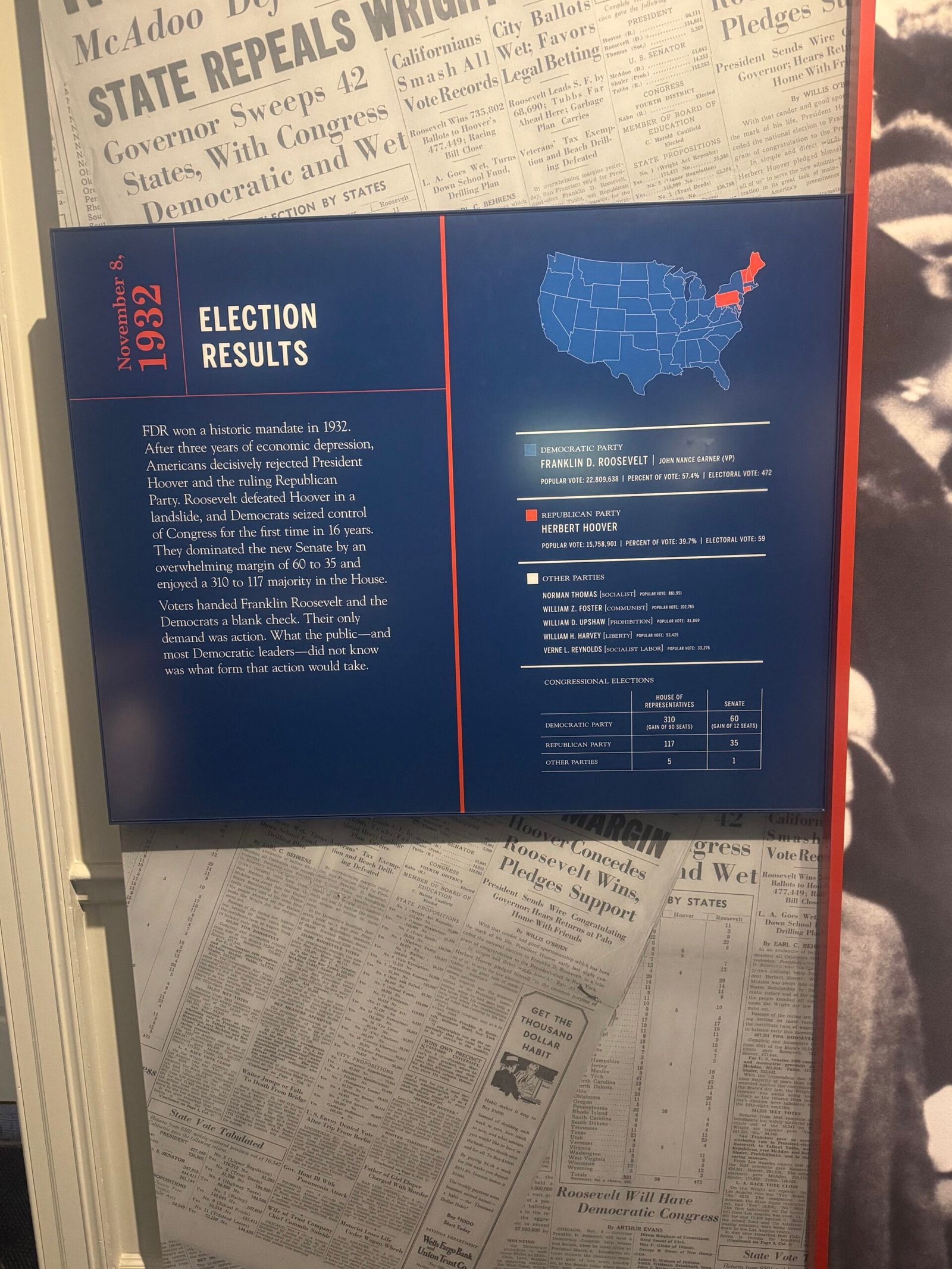
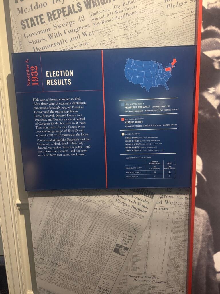
Saw this election results map at the FDR Museum a couple of days before the 2024 US Election. This is what I would call an overwhelming vote for one candidate!
The blurb says
“FDR won a historic mandate in 1932.
After three years of economic depression, Americans decisively rejected President Hoover and the ruling Republican Party. Roosevelt defeated Hoover in a landslide, and Democrats seized control of Congress for the first time in 16 years.
They dominated the new Senate by an overwhelming margin of 60 to 35 and enjoyed a 310 to 117 majority in the House.
Voters handed Franklin Roosevelt and the Democrats a blank check. Their only demand was action. What the public-and most Democratic leaders-did not know was what form that action would take.”You could reword this to fit today’s circumstances.
-
sur Mapping Marine Light and Noise Pollution
Publié: 12 December 2024, 11:41am CET par Keir Clarke
The AquaPLAN (Aquatic Pollution from Light and Anthropogenic Noise) is a new interactive map designed to address the pressing issue of pollution in aquatic environments. It is the first interactive map to visualize the extent of artificial light at night and anthropogenic noise pollution in European marine and freshwater habitats. Recent studies highlight the adverse impacts of light and noise
-
sur Mappery: Redlining
Publié: 12 December 2024, 11:00am CET
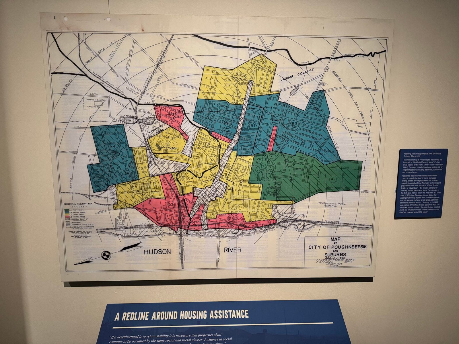

I spotted this map in Franklin Delano Roosevelt Museum, which had a special exhibition on FDR and Black African Americans.
Redlining Map of Poughkeepsie, New York and its Suburbs, March 1938
This redlining map of Poughkeepsie was among the hundreds of “Residential Security Maps” of urban areas created by the Home Owners’ Loan Corporation.The maps indicated mortgage lending risk by neighborhood type, including residential, commercial, and industrial areas. Residential districts were marked with different colors to indicate the level of risk in mortgage lending. Streets and neighborhoods that included minority (especially African American) and immigrant populations were often marked in RED as “Fourth Grade” or “Hazardous”— the riskiest category for federally insured homeowner loans. For example, in the BLUE area marked B3 on this map there is a small sliver of RED along Glenwood Avenue. Notes that accompany the map explain why: “Glenwood Avenue, which is shown in red, was an old Negro settlement before this area was built up.” Similarly, in the BLUE area marked B2 Pershing Avenue appears in RED. The mapmaker’s notes indicate: “Pershing Avenue (marked in red) has a number of negro families. Houses on this street are very poor and of little value.”
Not a lot seems to have changed!
-
sur The Interactive Murder Map
Publié: 11 December 2024, 12:05pm CET par Keir Clarke
Norwegian newspaper VG has been mapping murders in Norway since the turn of the millennium. The cumulative data in Murder in Norway allows the paper to provide some fascinating insights into Norwegian homicides. For example, this year, 61% of murder victims have been killed by a family member or a partner/ex-partner. Last year, 45% of murder victims were killed by their partner or ex-partner.
-
sur Mappery: Standing on New York State
Publié: 11 December 2024, 11:00am CET
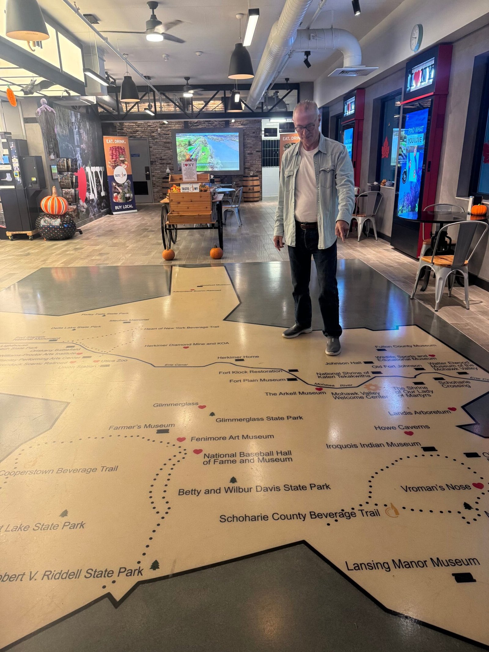
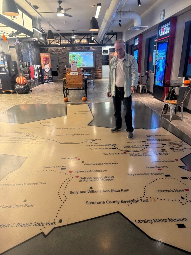
We stopped at a rest stop on our way south through New York State, you know I love a floor map! This one shows parks and museums in the state. I agree with the signs saying “I love NY”

-
sur Le blog de Geomatys: Stages 2025 !
Publié: 10 December 2024, 3:22pm CET
 Stages Geomatys pour 2025
- 10/12/2024
- Jordan Serviere
Geomatys propose pour 2025 deux nouvelles offres de stages :
 Montpellier – 3 à 6 mois
Traitement de données géospatiales pour un outil cartographique de prédictions de risques d’émergence de maladies infectieuses
Learn more Montpellier – 3 à 6 mois
 Entre mars et septembre 2025
Développement d’un algorithme de Machine Learning pour la prévision des pics de turbidité
Learn more Menu Linkedin
Twitter
Youtube

The post Stages 2025 ! first appeared on Geomatys.
-
sur Fernando Quadro: WebGIS sob Medida
Publié: 10 December 2024, 1:00pm CET
WebGIS é uma tecnologia usada para exibir e analisar dados espaciais na Internet. Ele combina as vantagens da Internet e do GIS oferecendo um novo meio de acessar informações espaciais sem a necessidade de você possuir ou instalar um software GIS.
A necessidade de divulgação de dados geoespaciais têm estimulado cada vez mais o uso de ferramentas WebGIS para apresentações interativas de mapas e de informações relacionadas por meio da internet.
As soluções adotadas na apresentação destes mapas devem apresentar um equilíbrio entre facilidade de uso, riqueza de recursos para visualização e navegação entre os dados, e funcionalidades geoespaciais para pós processamento, características que devem ser adequadas para cada perfil de usuário que acessará o WebGIS.
Se você e sua empresa possuem dados geoespaciais e querem disponibilizá-las na Web, o caminho natural para isso é o desenvolvimento de um WebGIS. Mas, se você não tiver uma equipe de TI, ou um especialista em desenvolvimento GIS, não se preocupe, a Geocursos pode te ajudar.
Nossa experiência em GIS nos habilita a entregar soluções baseadas nessa tecnologia utilizando ferramentas open source de visualização geográfica aliada a soluções criativas para o seu negócio.
 Quem saber mais?
Acesse e peça um orçamento: [https:]]
WhatsApp: [whats.link] -
sur Mappery: Clock Map
Publié: 10 December 2024, 11:00am CET

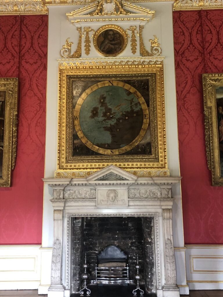
BarryRuderman of Raremaps.com shared this with us “Check out the anemoscope at Kensington Palace dating back to the reign of William III. #mapsinthewild #maps
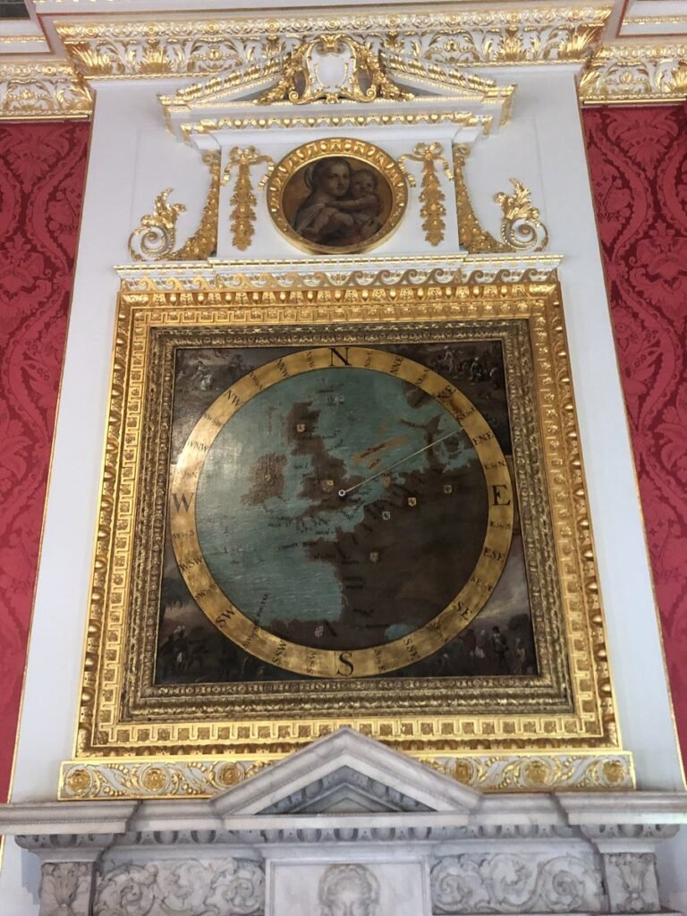
I love that London appears as the centre of the world (well Europe at least)
-
sur How Good is Your Map Memory?
Publié: 10 December 2024, 10:16am CET par Keir Clarke
Discover the World, One Click at a Time!Tripgeo has released another exciting, map-based game that challenges you to explore your geographic knowledge like never before! Map Memory allows you to center an interactive map anywhere in the world to create a unique map game, entirely based on the local geography.Whether you're a geography whiz or a curious traveler, Map Memory is perfect for anyone
-
sur OSGeo Announcements: [OSGeo-Announce] Tom Kralidis receives the 2024 Sol Katz Award
Publié: 10 December 2024, 10:00am CET
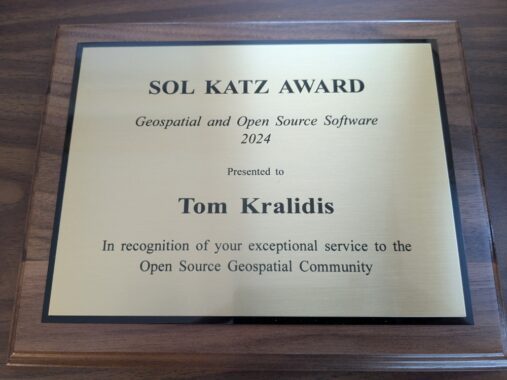
Tom Kralidis was honoured with the 2024 Sol Katz Award, presented on 6 December 2024 at FOSS4G 2024 in Belém, Brazil.
This was the 20th year of the award.
2024-12-09
We are honoured to announce that Tom Kralidis is the recipient of the 2024 Sol Katz Award.
You may know Tom through his activities within the GeoPython community, specifically through pygeoapi, pycsw, OWSLib, GeoHealthCheck, pygeometa, and the list goes on. Tom also plays a critical role in promoting OGC standards, throughout FOSS4G projects and also connecting the OGC + OSGeo communities.
Tom is very active at the OSGeo Board level, and other committees within the foundation. He is also active in the World Meteorological Organization (WMO).
But you will most likely know him from various FOSS4G workshops around the world, where he helps users share their spatial information through known standards and Open Source software.
Tom Kralidis is a longtime leader in the FOSS4G community, and it warms our heart to finally thank him for his decades of tireless effort, in promoting sharing.
The FOSS4G community is full of people doing amazing work, and today we take a moment to shine the spotlight on one person, who has long deserved a thank-you, Tom Kralidis.
Thanks Tom!
About the award
The Sol Katz Award for Free and Open Source Software for Geospatial (FOSS4G) is awarded annually by OSGeo to individuals who have demonstrated leadership in the FOSS4G community. Recipients of the award have contributed significantly through their activities to advance open source ideals in the geospatial realm. The award acknowledges both the work of community members, and pay tribute to one of its founders, for years to come.
Read more about Sol Katz at Awards

1 post - 1 participant
-
sur gvSIG Batoví: 3 LIBROS ACTUALES E IMPRESCINDIBLES
Publié: 9 December 2024, 7:52pm CET
-
sur Fernando Quadro: 12 características de um Profissional GIS
Publié: 9 December 2024, 1:00pm CET
No cenário geoespacial em rápida evolução de hoje, ser um profissional de GIS é mais do que apenas trabalhar com mapas e dados.
Requer uma mistura única de conhecimento técnico, pensamento crítico, criatividade e colaboração.
Quer você esteja apenas começando ou seja um especialista experiente, essas 12 características essenciais podem ajudá-lo a se destacar e prosperar na indústria geoespacial.
 Conhecimento em tecnologia
 Atenção aos detalhes
 Comunicador eficaz
 Estar sempre aprendendo
 Orientado por dados
 Colaborativo
 Gerente de projeto
 Pensador crítico
 Apaixonado por geografia
 Solucionador criativo de problemas
 Tomador de decisões
 Pensador analítico
Qual dessas características você acredita ser a mais importante para o sucesso em GIS? Conte nos comentários!
Fonte: webgis.tech
Instagram: [https:]]
LinkedIn: [https:]]
-
sur Do You Live in 15 Minute City?
Publié: 9 December 2024, 12:09pm CET par Keir Clarke
Imagine stepping out of your home and finding your favorite café, grocery store, and park just minutes away. For residents of New York or Seattle, this is a daily reality. But in sprawling cities like Houston or Indianapolis, such convenience remains a dream for many. Thanks to The Washington Post, you can now discover how walkable your city is compared to other U.S. cities.The Washington Post
-
sur Mappery: Bike Race
Publié: 9 December 2024, 11:00am CET
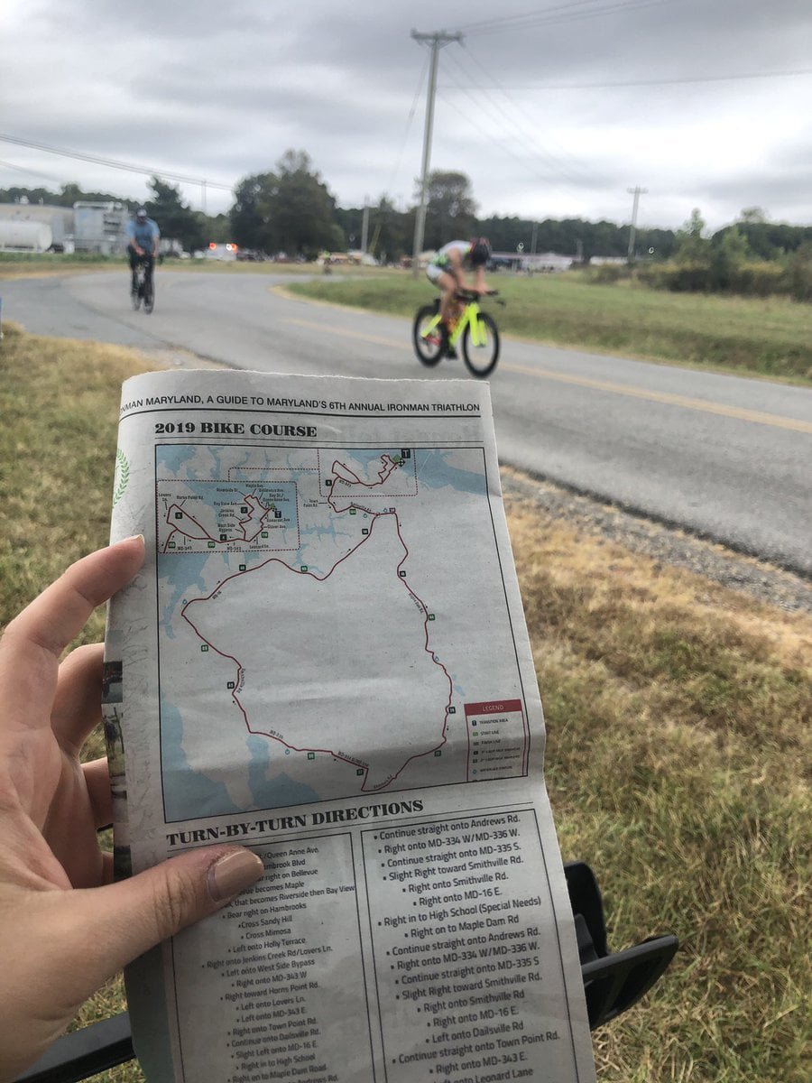
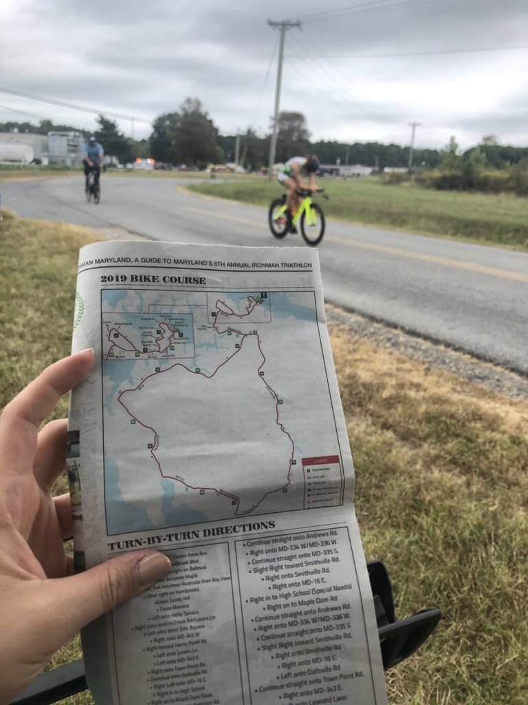
MaddieCaraway shared this “#MapsInTheWild- Navigating the bike course while I chase my dad @CarawayJd doing an @IRONMANtri!!
-
sur Mappery: Aberfan
Publié: 8 December 2024, 11:00am CET
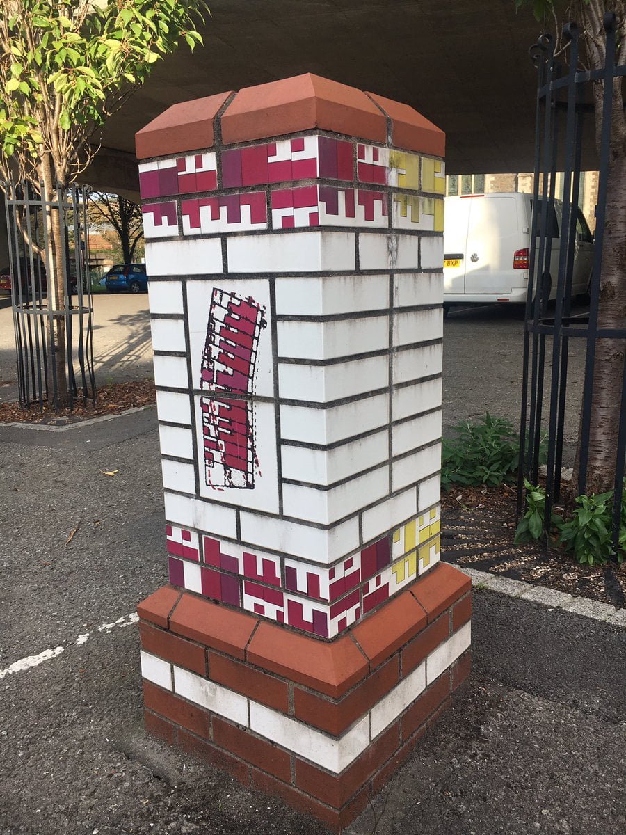
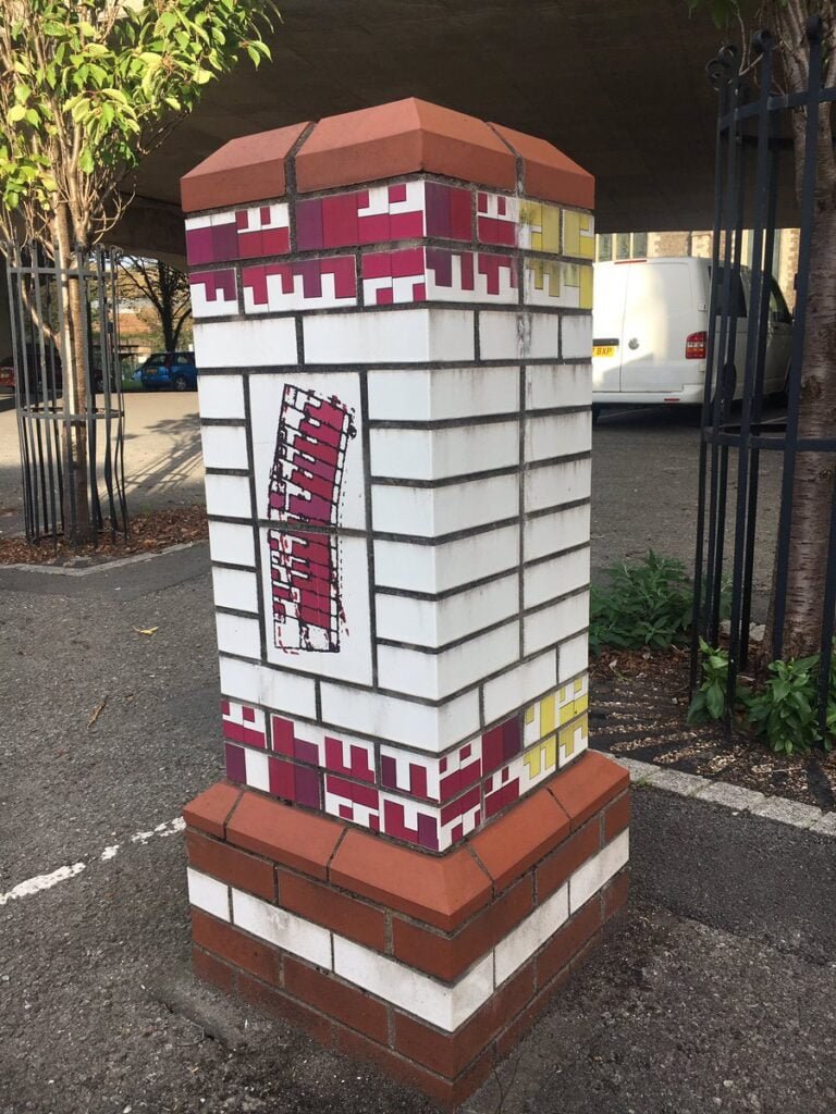
Nick Clark shared these Gatepost-style memorial to the houses which stood where Heilbronn Way now looms over Aberavon #MapsIntheWild

-
sur Sean Gillies: Late fall biking
Publié: 8 December 2024, 4:55am CET
I've decided to try to ride a bike for exercise more in 2025. Run harder, but run less, with more active recovery and low-intensity outings on a bike. At least until June, when I need to start building the running and hiking endurance that I will need in September.
I got a new bike to make this more fun. It's a Rocky Mountain Solo C50 and I bought it from my favorite local bike shop, Drake Cycles, last Saturday. The first thing I did was pedal it from home up Spring Creek Trail to Pineridge Open Space and ride some laps around the pond. It sure beats riding my commuter bike on dirt and gravel. I haven't bought a new bike or any new bike components in 10 years. Electronic shifters feel like magic to me.

A dark blue-green bike with wide drop handlebars leaning on an interpretive sign in a dry valley under and overcast sky.
So far this week I've done two rides from the barn where we keep our horses while Bea has been doing her equestrian stuff. One at sunset and one at sunrise. I've been three miles east of the barn and seven miles north of the barn, following roads on the PLSS section grid.

A dirt road at dusk, headlights of an approaching truck, and orange sunset glow behind the Rocky Mountains.
In the neighborhood of the barn, the ground is completely free of snow and quite dry. Passing trucks raise medium density clouds of dust. There are scattered homes out here, and vehicles going to and fro periodically. There are large construction sites, too, which can mean a wave of large rigs pulling trailers.

A rolling dirt road and brown grassland with snow-dusted mountains in the background.
I've got a lot to learn about this kind of riding. The right tire pressure for road and trail conditions, for example, and how to get in and out of the drops smoothly. How to descend and corner safely, and how to survive washboard surfaces. Dressing, too. I'm riding at a low intensity and don't generate as much heat as I do when I run.
One of my favorite things about riding further east is the panoramic views of the Front Range peaks. I can see Pikes Peak, Mount Evans, Longs Peak, and the Mummy Range, a span of 200 kilometers, from the top of every rise.
-
sur Sean Gillies: Productive running
Publié: 7 December 2024, 9:53pm CET
At last, I'm less than 1% injured and am getting back into regular and productive running. We've had a long stretch of mild and dry weather here, which makes it easy to just lace up and go. I ran four times last week, including a nice hilly run in Lory State Park, and will run three times this week. Thursday I did some harder running and a bunch of strides for the first time since June.
Some faint numbness lingers on my left quad, but my hip, butt, and leg are otherwise just fine. My doctor prescribed a course of prednisolone in early November to calm down my pinched nerve and that seemed to banish the last of my Achilles tendonitis as well. My right heel and calf haven't been pain-free in a long time. It's really nice to feel good.

Shoes, legs, and shorts in warm December sunshine
-
sur The Bellingcat Open Source Challenge
Publié: 7 December 2024, 1:37pm CET par Keir Clarke
Wordle and Minute Cryptic and Scrambled Maps will have to a back-seat this month - there's a new daily challenge in town: the Bellingcat Open Source Challenge.Launched by Bellingcat, a renowned platform for open-source research and investigative journalism, the Open Source Challenge is running throughout December. Five days a week, Bellingcat is posting a new challenge, inviting participants to
-
sur Mappery: New Hampshire – The Wooden State
Publié: 7 December 2024, 11:00am CET
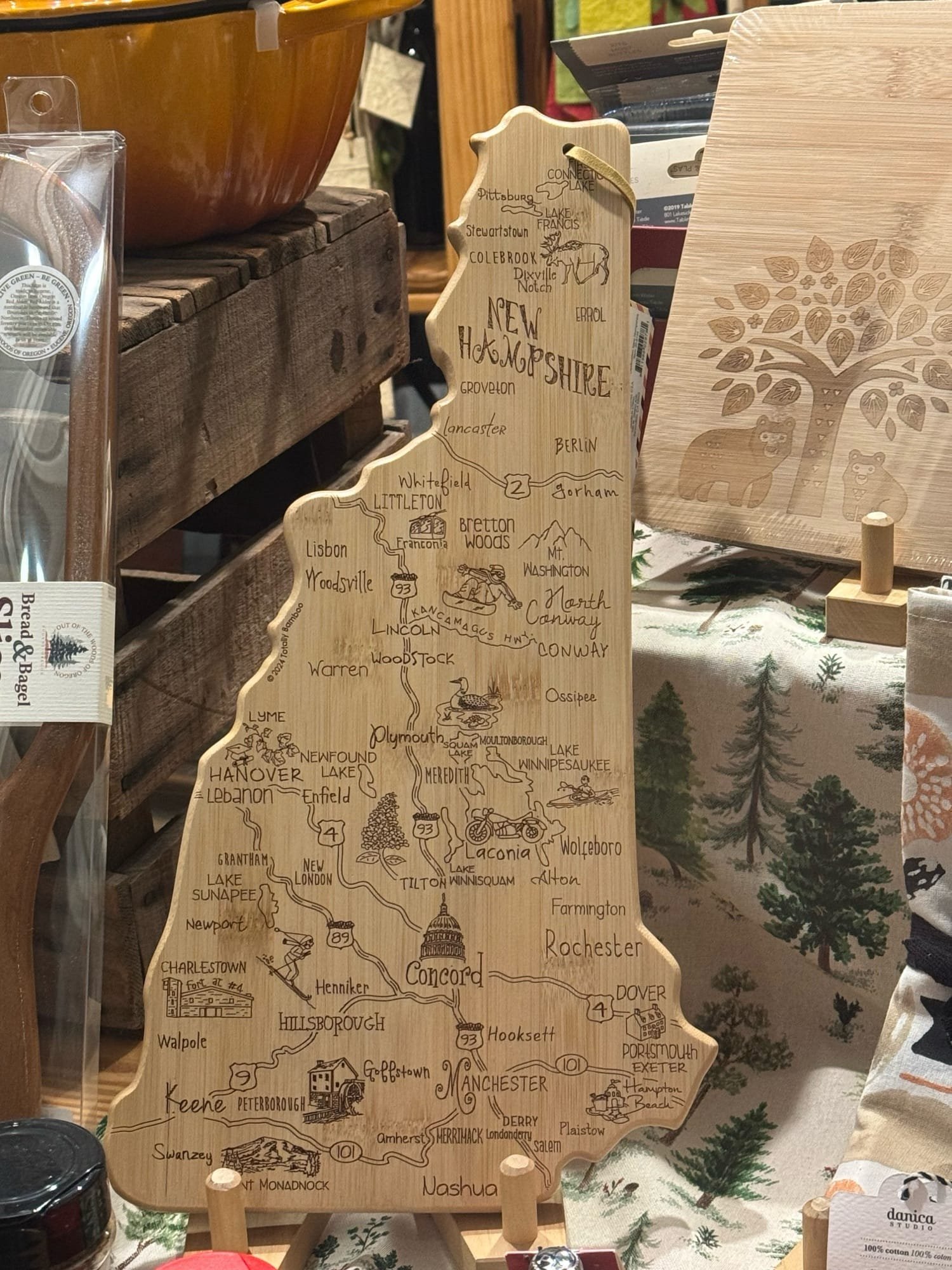
I spotted this neat wooden cheeseboard in the shape of New Hampshire in Portsmouth at the beginning of our road trip through New England.
-
sur SIG Libre Uruguay: 3 LIBROS ACTUALES E IMPRESCINDIBLES
Publié: 6 December 2024, 5:05pm CET
-
sur US Segregation Maps
Publié: 6 December 2024, 12:24pm CET par Keir Clarke
Visualizing U.S. Segregation Through Interactive MapsCensus Dots is an interactive map of 2020 U.S. census data. On the map, millions of colored dots each represent one individual. The colors indicate the race or ethnicity that individuals identified with in the 2020 Census. Although the map does not mention this explicitly, most census dot maps randomize the locations of dots within each
-
sur Mappery: Goose Creek
Publié: 6 December 2024, 11:00am CET
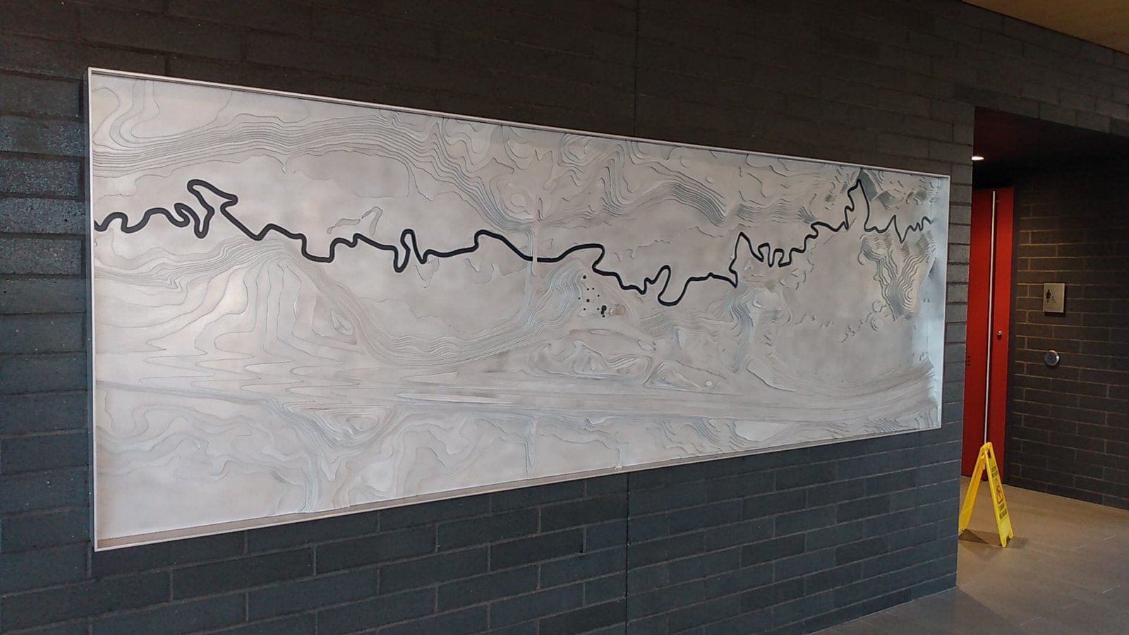
Corvus sent us this 3D relief map at the Goose Creek rest area in Minnesota. Looks pretty big to me
-
sur WhereGroup: Datenschutzkonforme Bildveröffentlichung: Gesichter und Nummernschilder automatisch verpixeln mit Python
Publié: 6 December 2024, 10:05am CET
Autokennzeichen und Gesichter verpixeln und datenschutzkonforme Bilder erstellen mit Python in nur wenigen Schritten. Wir zeigen wie’s geht. -
sur SourcePole: FOSS4G 2024 Belém
Publié: 6 December 2024, 1:00am CET
FOSS4G is the annual global event of free and open source geographic technologies and open geospatial data hosted by OSGeo. In 2024 it took place in Belém, Brasil.
-
sur Fernando Quadro: 10 aplicações GIS em Energias Renováveis
Publié: 5 December 2024, 1:00pm CET
À medida que o mundo transita para um futuro energético mais limpo e sustentável, o papel dos Sistemas de Informação Geográfica (GIS) se tornou indispensável.
O GIS nos permite enfrentar os desafios complexos do desenvolvimento de energia renovável com precisão e eficiência.
Seja identificando os principais locais para fazendas solares, avaliando o potencial de energia eólica ou planejando infraestrutura hidrelétrica, o GIS fornece os insights espaciais necessários para tomar decisões informadas.
Além do planejamento de projetos, o GIS oferece suporte a avaliações ambientais, mitiga riscos e ajuda a integrar energia renovável em redes elétricas, garantindo que esses desenvolvimentos sejam sustentáveis e resilientes.
Ele também capacita provedores de energia e formuladores de políticas a envolver comunidades, reduzir emissões e enfrentar as mudanças climáticas de frente.
Aqui estão 10 maneiras principais pelas quais o GIS está moldando o setor de energia renovável, promovendo inovação e impulsionando mudanças impactantes:
 Integração da Rede
 Avaliação de Recursos
 Avaliação de Impacto Ambiental
 Engajamento da Comunidade
 Análise de Risco
 Monitoramento e Manutenção
 Análise de Uso do Solo
 Planejamento de Infraestrutura Energética
 Mitigação de Mudanças Climáticas
 Mapeamento de Demanda Energética
Gostou desse post? Conte nos comentários

Fonte: webgis.tech
Instagram: [https:]]
LinkedIn: [https:]]
-
sur North America's Shrinking Railways
Publié: 5 December 2024, 11:48am CET par Keir Clarke
Passenger rail services in 1980 and 2024 interactive map visualizes the Amtrak (red) and VIA Rail (blue) systems in 1980 and 2024, alongside independent railways and commuter services (green). The map highlights a notable decline in the availability of passenger rail services in both the USA and Canada over the last 44 years.Using the map's slide control, you can easily switch between the
-
sur Mappery: van Eesteren
Publié: 5 December 2024, 11:00am CET
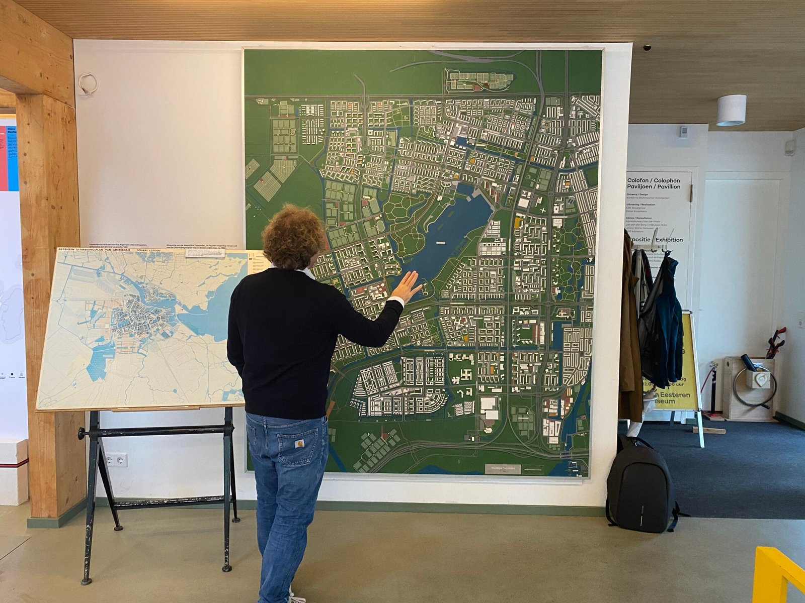
Reinder shared this pic from his visit to the van Eesteren Pavilion at a museum in Amsterdam dedicated to the Dutch architect Van Eesteren (1897-1988). Looks like someone is getting “hands on”
-
sur OTB Team: Look back on the OTB Users Days 2024
Publié: 5 December 2024, 9:55am CET
The OTB Users Days 2024 were held on November 21th and 22th at Artilect Fablab in Toulouse. Thanks to everyone who attended the event! Plenary Talks On Thursday several talks were given on various subjects: On Friday morning, we had a presentation of the PLUTO portal (video) Brainstorming session On Thursday and Friday afternoons, we […]
-
sur The Bird Migration Atlas
Publié: 4 December 2024, 2:29pm CET par Keir Clarke
The European Turtle Dove is a relatively small bird, weighing only about 100 grams (3.5 ounces). Despite its size, the European Turtle Dove undertakes an incredible long-distance migration of around 5,000 kilometers (3,000 miles) from Europe to sub-Saharan Africa every year. This remarkable journey, along with the migratory routes of hundreds of other bird species, can be explored in detail on
-
sur Fernando Quadro: WebGIS para monitoramento de Terras Indígenas
Publié: 4 December 2024, 1:00pm CET
Terras indígenas, como a tribo Alto Turiaçu no Maranhão, enfrentam ameaças crescentes de incêndios florestais. Para ajudar na proteção dessas áreas, a Jéssica Uchoa criou uma aplicação WebGIS que monitora focos de incêndio e analisa seus impactos com dados geoespaciais em tempo real e históricos.
 Como funciona:
 FIRMS (NOAA-21) Realizar o monitoramento de focos de incêndio em tempo real (últimas 24h);
 Sentinel-2: Análise de cicatrizes de queimadas com imagens de alta resolução;
 MIRBI: Identificação de pontos ativos de incêndio;
 Camadas do IBGE: Fornece a localização de territórios indígenas, ajudando na orientação e no planejamento das análises.
Você pode acessar uma versão do WebGIS no seguinte link: [https:]
Gostou desse post? Conte nos comentários

Fonte: webgis.tech
Instagram: [https:]]
LinkedIn: [https:]] -
sur Mappery: Cité de l’espace
Publié: 4 December 2024, 11:00am CET
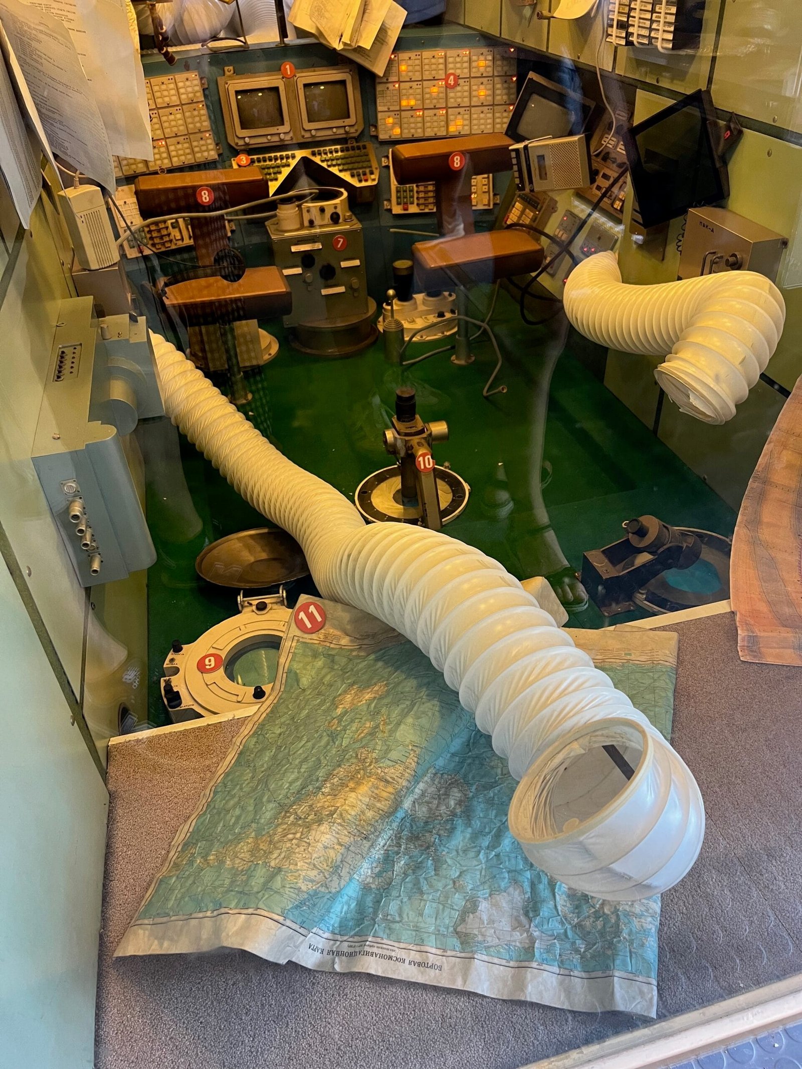
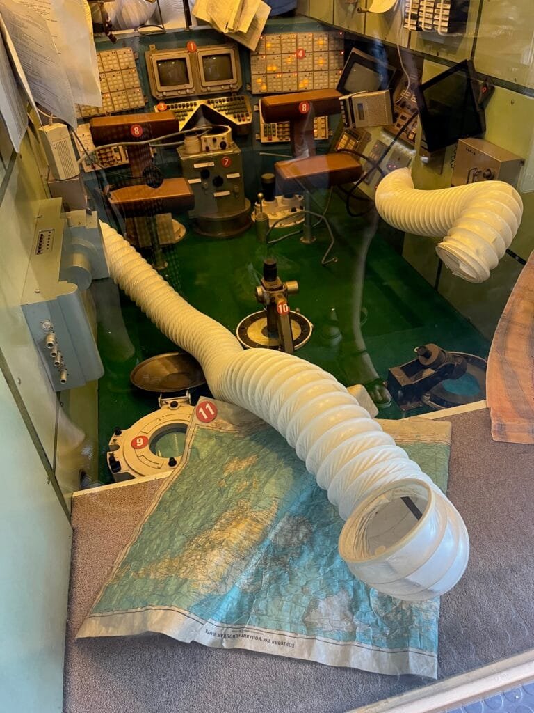
Camille found a map in a Mir space station module displayed at the Cité de l’espace, Toulouse, France.
-
sur Camptocamp: Camptocamp and IGN Partnership Wins 2024 Acteurs du Libre Award for Best Public-Private Collaboration
Publié: 4 December 2024, 1:00am CET
Pièce jointe: [télécharger]
We’re delighted to announce that Camptocamp, alongside our partner IGN (Institut National de l'Information Géographique et Forestière), has been awarded the prestigious 2024 Acteurs du Libre Prize in the category of Best Public-Private Collaboration. -
sur Fernando Quadro: Segredos para desenvolver seu WebGIS
Publié: 3 December 2024, 7:18pm CET
Você está enfrentando problemas no desenvolvimento do seu WebGIS?
Deixe-me poupar algum tempo da sua frustração, pois você pode estar cometendo alguns erros comuns:
 Pular direto para a codificação sem um roteiro
 Seguir tutoriais que só fazem sentido se você já tiver conhecimento dos termos do WebGIS
 Tentar construir ferramentas sem entender o fluxo de dados no WebGIS
 Perder tempo “ajustando” ferramentas sem ter a mínima ideia de onde o código deveria ficar
Parece familiar?
Vou te contar alguns “segredos” para o desenvolvimento do seu WebGIS:
 Entenda o fluxo de dados e os termos essenciais
 Saiba exatamente quais elementos de programação são essenciais
 Domine o uso das bibliotecas WebGIS para obter exatamente o que precisava
Gostou desse post? Conte nos comentários

Fonte: webgis.tech
Instagram: [https:]]
LinkedIn: [https:]]
-
sur The Joy-Plot Map of Europe
Publié: 3 December 2024, 11:24am CET par Keir Clarke
The Ridgeline Map of European Population Density is an interactive map that provides a multi-resolution visualization of Europe's population density in the form of a joy-plot.Joy-plots, also known as ridgeline plots, draw their inspiration from one of pop culture’s most iconic visuals: the album cover of Unknown Pleasures by Joy Division. Designed by Peter Saville in the 1970s, the cover
-
sur Mappery: Indian Taxi
Publié: 3 December 2024, 10:00am CET


Elizabeth spotted this Map in the Wild on her travels in India

-
sur Camptocamp: Exploring Innovation: Camptocamp at Open Source Experience 2024
Publié: 3 December 2024, 1:00am CET
Pièce jointe: [télécharger]
As a committed contributor to the Open Source Ecosystem, we look forward to presenting two talks that highlight how these technologies address real-world challenges and drive meaningful solutions. -
sur Mappery: Slovenia beer map
Publié: 2 December 2024, 11:00am CET
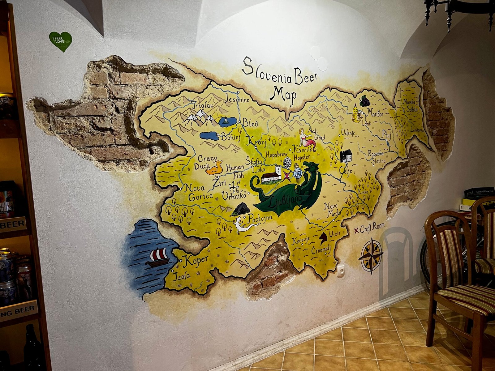
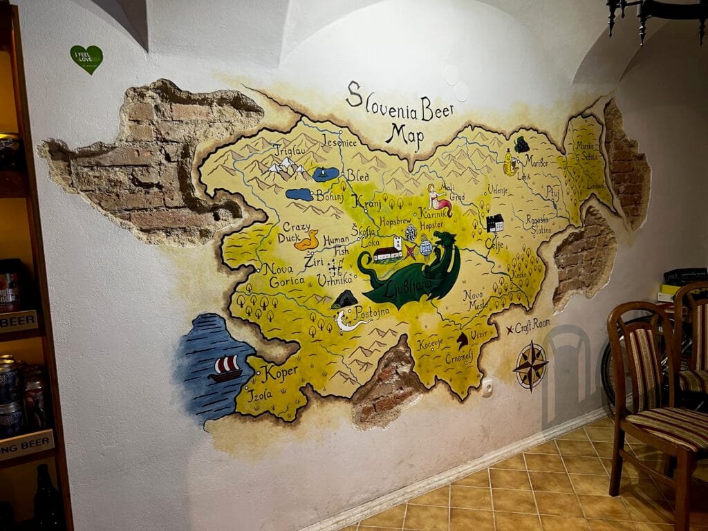
I found this map while visiting a craft beer place named Craft Room, in Ljubljana, Slovenia
-
sur Geotripper - the Traveling Salesman Game
Publié: 2 December 2024, 9:10am CET par Keir Clarke
Only a few days after the release of the flight sim game Travel Cat the prolific TripGeo is back with another entertaining geographical map game. GeoTripper offers players a unique challenge: charting the shortest possible route through a series of random destinations around the globe! GeoTripper is a lot of fun to play. I was fortunate enough to get a sneak peek of the game over
-
sur BostonGIS: PostGIS Day 2024 Summary
Publié: 1 December 2024, 11:59pm CET
PostGIS Day yearly conference sponsored by Crunchy Data is my favorite conference of the year because it's the only conference I get to pig out on PostGIS content and meet fellow passionate PostGIS users pushing the envelop of what is possible with PostGIS and by extension PostgreSQL. Sure FOSS4G conferences do have a lot of PostGIS content, but that content is never quite so front and center as it is on PostGIS day conferences. The fact it's virtual means I can attend in pajamas and robe and that the videos come out fairly quickly and is always recorded. In fact the PostGIS Day 2024 videos are available now in case you wanted to see what all the fuss is about.
Continue reading "PostGIS Day 2024 Summary" -
sur Mappery: Christmas season begins
Publié: 1 December 2024, 10:00am CET


Raremaps.com (Barry Ruderman) spotted the Christmas decoration at Heceta Head Lighthouse on the Oregon Coast
-
sur Mappery: Wait, is it Halloween?
Publié: 30 November 2024, 11:00am CET
Pièce jointe: [télécharger]
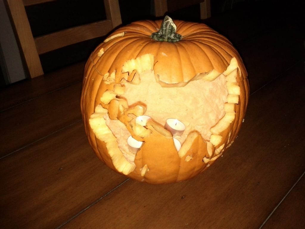

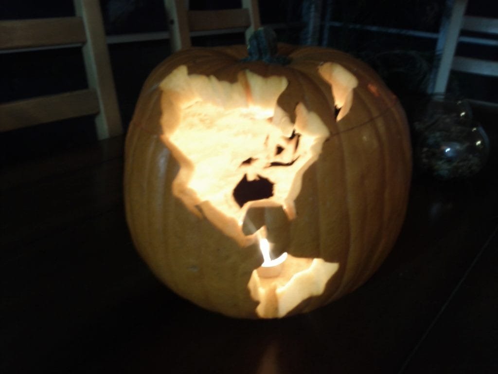
Ken Field once carved a pumpkin, but, of course, it was a globe. It was from Halloween a few years ago.
-
sur Lifetime Net Elevation Scores
Publié: 30 November 2024, 9:46am CET par Keir Clarke
Topi Tjukanov's popular Notable People map highlights the most "notable" person born in specific locations around the world. The designation of "most notable" is determined based on the highest number of page views of individuals listed on Wikipedia's "People from X" pages.I’ve often pondered the idea of creating a complementary Notable Deaths map that showcases the most famous person to have
-
sur Mappery: Franklin D. Roosevelt Presidential Library and Museum
Publié: 29 November 2024, 11:00am CET

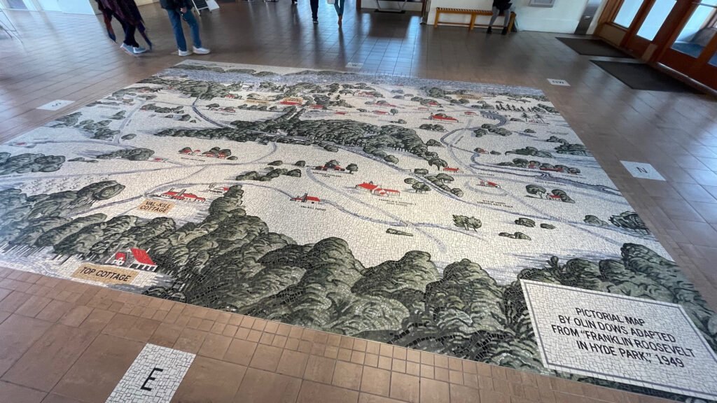
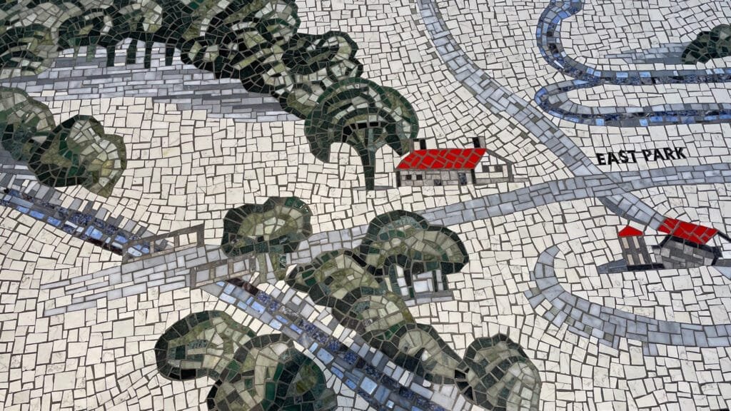
?Rick Lederer-Barnes shared this photos from the Franklin D. Roosevelt Presidential Library and Museum
-
sur Travel Cat's Aerial Adventures
Publié: 29 November 2024, 10:34am CET par Keir Clarke
I have seen a few flight simulator games created with 3D maps over the years,, but Travel Cat to let you pilot a plane as a cat. Flying a feline-piloted plane past the Eiffel Tower in Paris or around the Statue of Liberty in New York is as enchanting as it sounds. It is also a lot of fun.Travel Cat uses the Google Maps API's 3D view to create a basic flight simulator that allows you to
-
sur Mappery: WGS84
Publié: 28 November 2024, 11:00am CET
Pièce jointe: [télécharger]

Javier Jimenez Shaw shared this mappy licence plate
-
sur Drowning in Plastic
Publié: 28 November 2024, 10:34am CET par Keir Clarke
There are five large ocean garbage patches. Most people have heard of the Great Pacific Garbage Patch, but there are also the North Atlantic, South Atlantic, Indian Ocean, and South Pacific garbage patches.These garbage patches form due to ocean currents called gyres, which trap floating debris in circulating patterns. Over time, waste such as plastic bottles, fishing nets, and microplastics
-
sur geomatico: Geomatico ya es socio de QGIS España
Publié: 27 November 2024, 2:37pm CET
En Geomatico creemos firmemente en la colaboración como motor para impulsar la innovación y la excelencia en nuestro sector. Por ello, hemos decidido asociarnos a QGIS España, una organización que comparte nuestra pasión por los sistemas de información geográfica (SIG) y el código abierto. Esta alianza refuerza nuestro compromiso con el uso de herramientas accesibles y de alta calidad para ofrecer soluciones geoespaciales avanzadas a nuestros clientes.
Esta asociación nos permitirá estar más conectados con la comunidad de usuarios y desarrolladores de QGIS en España, lo que abre nuevas oportunidades de aprendizaje, intercambio de conocimientos y participación en iniciativas conjuntas. Estamos convencidos de que trabajar de la mano con QGIS España no solo beneficiará a nuestros proyectos actuales, sino que también contribuirá al desarrollo del ecosistema SIG a nivel nacional.

Nuestra asociación con QGIS España también refleja nuestra visión de contribuir activamente al desarrollo de la tecnología SIG open source en el ámbito nacional. Al formar parte de esta comunidad, no solo apoyamos una herramienta clave en nuestro sector, sino que también fomentamos el avance de soluciones de código abierto que promueven la sostenibilidad y la accesibilidad tecnológica.
-
sur Mapping the Underground Art Scene
Publié: 27 November 2024, 10:12am CET par Keir Clarke
Earlier this month Maps Mania reviewed Subway Stories, a visualization of subway journeys on the NYC subway system. The map was developed for the 2024 MTA Open Data Challenge. Now, the MTA has announced the winner of that challenge: Art Off the Rails, an interactive map showcasing the artworks of the MTA.Art Off the Rails uses the MTA's extensive art catalog to map the locations
-
sur Mappery: Florentine Map Window
Publié: 27 November 2024, 10:00am CET

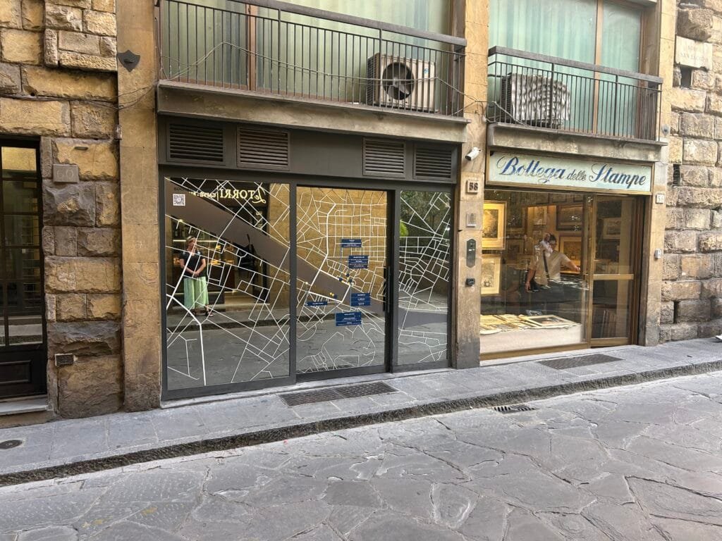
David Sherren said “I spotted this rather attractive office window in the Borgo San Jacopo, Florence, promoting a collection of hotels. As a bonus, there were some nice maps for sale at the print dealer next door.”
I’m a bit confused by some of the writing being on the inside of the window.
-
sur Travel Times in the Roman & British Empires
Publié: 26 November 2024, 6:30pm CET par Keir Clarke
In Jane Austen's Pride and Prejudice, the heroine Elizabeth Bennet marries Fitzwilliam Darcy. This marriage separates Elizabeth from the rest of her family, both in terms of class and physical distance. As the new mistress of Pemberley, Darcy's grand estate in Derbyshire, Elizabeth must move over 130 miles away from her childhood home of Longbourn, in rural Hertfordshire.While 130 miles might -
sur Mapping the U.S. Electoral Divide
Publié: 26 November 2024, 11:11am CET par Keir Clarke
In the United States, a persistent and striking political divide is evident between urban and rural areas. High-density urban regions overwhelmingly tend to support Democratic candidates, while low-density rural areas lean Republican. This geographical polarization shapes the outcomes of elections and reflects broader cultural, economic, and ideological divisions. A compelling exploration
-
sur Mappery: At York Station
Publié: 26 November 2024, 11:00am CET
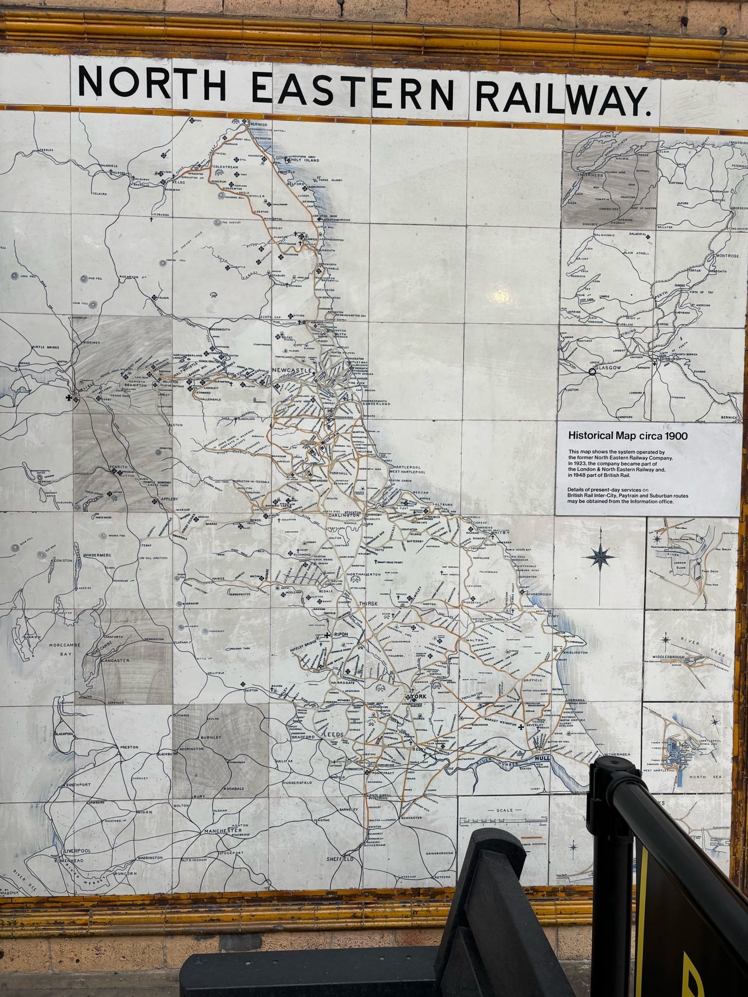
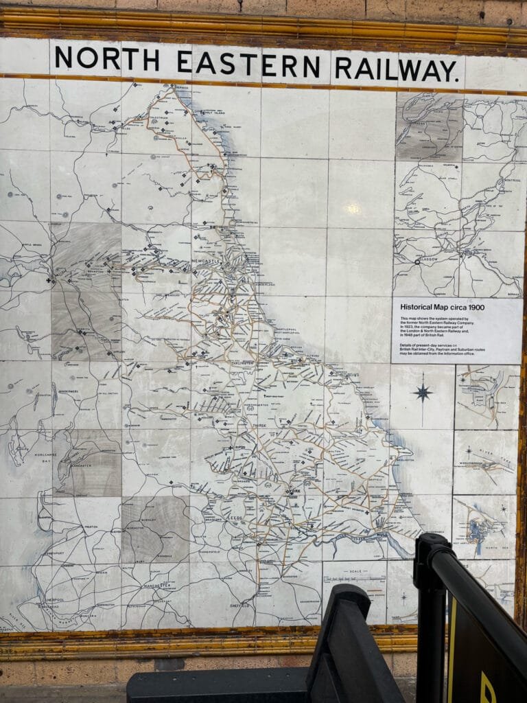
Photo from Doug Greenfield
-
sur Mappery: Global incarceration rates
Publié: 25 November 2024, 11:00am CET


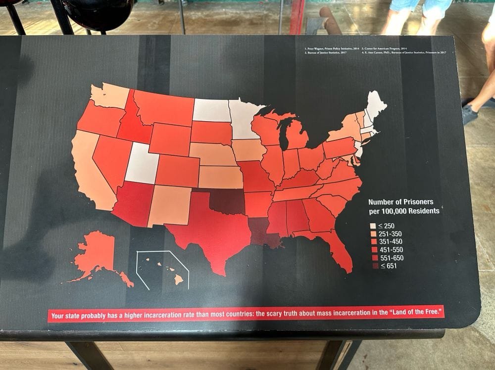
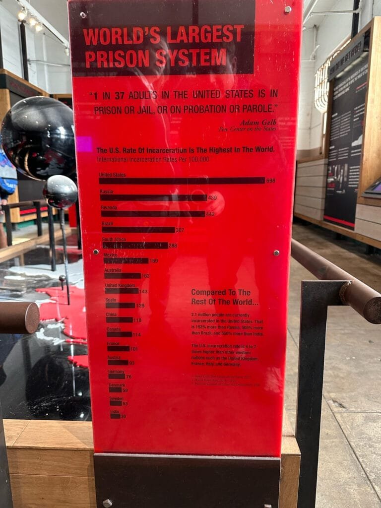
Robert Simmon comments on the Global incarceration rates displayed in Alcatraz: “The Park Service is doing a great job of having a point of view with an almost purely data-driven design”.
-
sur Giant Dancing Virtual Geoglyphs
Publié: 25 November 2024, 10:26am CET par Keir Clarke
@duncan77mccabe Strava art animation through the streets of Toronto! This took me 121 runs from January to October 2024. #strava #running #toronto #purplehat #active #run #Canada #motivation #madden25 #ncaa #purple #hat #sofitukker #sofi #tukker ? original sound - Duncan McCabe Accountant and avid runner Duncan McCabe has invented a new form of art - virtual animated geoglyphs. Using the
-
sur From GIS to Remote Sensing: Tutorial: Download Sentinel-2 data and calculate the NDVI in Python using Remotior Sensus
Publié: 24 November 2024, 3:21pm CET
 This post is about Remotior Sensus, a Python package that allows for the processing of remote sensing images and GIS data.In this tutorial we'll see how to search and download Sentinel-2 images and calculate the Normalized Difference Vegetation Index (NDVI) using Remotior Sensus.Following the video of this tutorial.
Read more » -
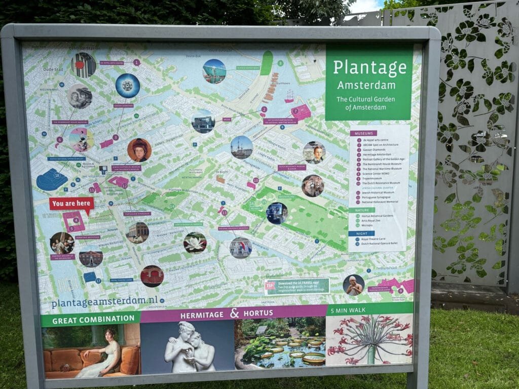
sur Mappery: Plantage district Amsterdam
Publié: 24 November 2024, 11:00am CET
-
sur Free and Open Source GIS Ramblings: GeoParquet in QGIS – smaller & faster files for the win!
Publié: 23 November 2024, 10:23pm CET
tldr; Tired of working with large CSV files? Give GeoParquet a try!
“Parquet is a powerful column-oriented data format, built from the ground up to as a modern alternative to CSV files.” [https:]]
(Geo)Parquet is both smaller and faster than CSV. Additionally, (Geo)Parquet columns are typed. Text, numeric values, dates, geometries retain their data types. GeoParquet also stores CRS information and support in GIS solutions is growing.
I’ll be giving a quick overview using AIS data in GeoPandas 1.0.1 (with pyarrow) and QGIS 3.38 (with GDAL 3.9.2).
File sizeThe example AIS dataset for this demo contains ~10 million rows with 22 columns. I’ve converted the original zipped CSV into GeoPackage and GeoParquet using GeoPandas to illustrate the huge difference in file size: ~470 MB for GeoParquet and zipped CSV, 1.6 GB for CSV, and a whopping 2.6 GB for GeoPackage:
 Reading performance
Pandas and GeoPandas both support selective reading of files, i.e. we can specify the specific columns to be loaded. This does speed up reading, even from CSV files:
Whole file Selected columns CSV 27.9 s 13.1 s Geopackage 2min 12s 
20.2 s GeoParquet 7.2 s 4.1 s Indeed, reading the whole GeoPackage is getting quite painful.
Here’s the code I used for timing the read times:

As you can see, these times include the creation of the GeoPandas.GeoDataFrame.
If we don’t need a GeoDataFrame, we can read the files even faster:
Non-spatial DataFramesGeoParquet files can be read by non-GIS tools, such as Pandas. This makes it easier to collaborate with people who may not be familiar with geospatial data stacks.
And reading plain DataFrames is much faster than creating GeoDataFrames:

But back to GIS …
GeoParquet in QGISIn QGIS, GeoParquet files can be loaded like any other vector layer, thanks to GDAL:

Loading the GeoParquet and GeoPackage files is pretty quick, especially if we zoom into a small region of interest (even though, unfortunately, it doesn’t seem possible to restrict the columns to further speed up loading). Loading the CSV, however, is pretty painful due to the lack of spatial indexing, which becomes apparent very quickly in the direct comparison:
 (You can see how slowly the red CSV points are rendering. I didn’t have the patience to include the whole process in the GIF.)
As far as I can tell, my QGIS 3.38 ‘Grenoble’ does not support writing to or editing of GeoParquet files. So I’m limited to reading GeoParquet for now.
However, seeing how much smaller GeoParquets are compared to GeoPackages (and also faster to write), I hope that we will soon get the option to export to GeoParquet.
For now, I’ll start by converting my large CSV files to GeoParquet using GeoPandas.
More readingIf you’re into GeoJSON and/or PyGeoAPI, check out Joana Simoes’ post: “Navigating GeoParquet: Lessons Learned from the eMOTIONAL Cities Project”
And if you want to see a global dataset example, have a look at Matt Travis’ presentation using Overture data:
-
sur I'm Sending You Back to the Future!
Publié: 23 November 2024, 12:03pm CET par Keir Clarke
I've spent today on a time-traveling adventure through 18th-century London. Standing in the bustling, tourist-filled Trafalgar Square, I opened up Allmaps Here and was instantly transported back to King’s Mews - an elaborate courtyard that stood here long before the Battle of Trafalgar was fought and etched its name onto London's streets. Suddenly the city came alive with elegant Georgian charm
-
sur Mappery: Upside down
Publié: 23 November 2024, 11:00am CET


Michaël Galien shared this photo of a former globe converted into a lamp, placing the South on top of it

-
sur Bluesky Mapping
Publié: 22 November 2024, 11:00am CET par Keir Clarke
Update 2: And here is a third map. EU Skeet Capitals replaces the place-name labels of EU capital cities with the latest Bluesky messages which mention the city.Update: I got busy and created a second map. Social Media Locations (comment below with suggestions for a better name). This map allows you to search for real-time Bluesky mentions of locations around the world. To start a search you
-
sur Mappery: Chopping boards
Publié: 22 November 2024, 11:00am CET


Cartonaut saw these chopping boards at Costco
-
sur Mappery: Underground at St Pancras
Publié: 21 November 2024, 11:00am CET
Pièce jointe: [télécharger]

Doug Greenfield shared this map situated in the underground at St Pancras
-
sur Mapping Mythical Islands & Imaginary Lands
Publié: 21 November 2024, 9:24am CET par Keir Clarke
Hy-Brasil is a mythical island, which was once believed to be located west of Ireland. According to legend, the island was typically shrouded in mist and only visible once every seven years. It appeared on several maps from the 14th to 16th centuries, often depicted as a circular island divided by a central river or strait.Hy-Brasil is also shown in the Atlantic Ocean near Ireland on Map
-
sur Mappery: Florida place mat
Publié: 20 November 2024, 11:00am CET

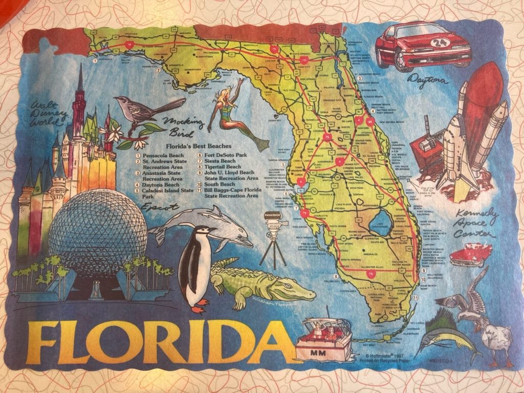
Courtney Shannon shared this place mat
-
sur The World's Changing Climate Zones
Publié: 20 November 2024, 10:04am CET par Keir Clarke
Climate change is one of the defining challenges of our time. It is more important than ever to visualize and understand its likely impacts. The new Köppen-Geiger Explorer hopes to meet this challenge by providing a powerful and interactive way to visualize climate zones and their transitions over time, based on the widely used Köppen-Geiger climate classification system.The Köppen-Geiger
-
sur OSGeo Announcements: [OSGeo-Announce] FOSS4G Europe 2024 Tartu final press release
Publié: 19 November 2024, 10:05pm CET
News item: FOSS4G Europe 2024 Tartu final press release - OSGeo
November 2024Dear OSGeo community,
it has now been some months since FOSS4G Europe 2024 in Tartu, Estonia.
We, the LOC would like to thank you all for your participation, either on site or via the interwebs, for your proposals for presentations and workshops - you helped us put together this amazing event in our hometown. You've helped us create something that will always have a very special place in our hearts.
The final press-release for FOSS4G Europe 2024 is - finally
 - ready and can be accessed under the foundation news at osgeo.org [1]. Further links to photos, presentation videos on TIB-AV portal and YouTube, and to the academic track proceedings are all in there.
We hope you enjoyed your time in Tartu, and in the surrounding areas if you had time to explore a bit more.
So one last time - on behalf of the FOSS4G Europe 2024 LOC, thank you and see you very soon.
Tõnis Kärdi
FOSS4G Europe 2024 chair[1] - FOSS4G Europe 2024 Tartu final press release - OSGeo
About FOSS4G Europe
--------------------------------
The FOSS4GE conference, a European extension of the Open Source Geospatial Foundation (OSGeo) annual FOSS4G event, connects professionals in the geoinformation software realm. FOSS4G Europe 2024 in Tartu was the eastern and northernmost (and as it turned out - largest) ever FOSS4G Europe conference to date. 2024.europe.foss4g.org
FOSS4G Europe 2024
The FOSS4G Europe 2024 conference is taking place 1-7 July in the beautiful city of Tartu, Estonia.
 OSGeo
OSGeo
 FOSS4G (Events) - OSGeo
With a robust schedule of keynote speakers, workshops, paper sessions and talks, FOSS4G offers a great opportunity for newcomers and regular visitors alike. This ‘annual gathering of the tribes’ boasts: A massive selection of presentations A...
Est. reading time: 2 minutes
About OSGeo
-------------------
The Open Source Geospatial Foundation (OSGeo) is a non-profit
organization dedicated to the development and promotion of open-source
geospatial technologies and data. OSGeo serves as an umbrella
organization for the collaborative development of open source
geospatial software, and provides financial, organizational, and legal
support to the broader geospatial community. OSGeo
OSGeo - OSGeo
OSGeo
OSGeo - OSGeo
OSGeo, the OpenSource for GeoSpatial Fosters global adoption of open geospatial technology by being an inclusive software foundation.
_______________________________________________
Announce mailing list
Announce@lists.osgeo.org
[https:]]1 post - 1 participant
-
sur GeoTools Team: GeoTools 32.1 released
Publié: 19 November 2024, 8:53pm CET
GeoTools 32.1 released The GeoTools team is pleased to announce the release of the latest stable version of GeoTools 32.1: geotools-32.1-bin.zip geotools-32.1-doc.zip geotools-32.1-userguide.zip geotools-32.1-project.zip This release is also available from the OSGeo Maven Repository and is made in conjunction with GeoServer 2.26.1 and GeoWebCache 1.26.1. -
sur OSGeo Announcements: [OSGeo-Announce] Welcoming our new OSGeo Charter Members 2024
Publié: 19 November 2024, 8:51pm CET
News item: Welcoming our new OSGeo Charter Members 2024 - OSGeo
November 2024OSGeo would like to welcome our new OSGeo Charter Members 2024.
We are happy to announce that the following people were accepted as OSGeo Charter Members:
Alberto Vavassori from Italy
Caitlin Haedrich from United States of America
Cholena Smart from Australia
Claudio Iacopino from Italy
Dave Barter from United Kingdom
Felipe Matas from Chile
Gresa Neziri from Kosovo
Hamidreza Ostadabbas from Iran
Mathieu Pellerin from Cambodia
Matthias Daues from Germany
Maxime Collombin from Switzerland
Petr Sevcik from Czech Republic
Ponciano da Costa de Jesus from Timor-Leste
Sami Mäkinen from Finland
Scott McHale from Canada
Tobias Wendorff from Germany
Vasil Yordanov from Bulgaria
Vincent Sarago from France
William Dollins from United States of America
Youssef Harby from EgyptYou are welcome to find out about our new members at the following page New Member Nominations 2024 - OSGeo
In 2024, we had 21 valid nominations and all were accepted.
This year 300 charter members casted their vote.
The board approved the new members in November 2024.OSGeo has 580 charter members
- from 74 countries
- 11 are retiredThanks a lot to Luís Moreira de Sousa, Iván Sánchez Ortega, Vicky Vergara (2024 OSGeo Elections CROs) for organizing the OSGeo Election 2024.
Share thisSee the full list of the OSGeo Charters member and find a link to every profile page there [https:]]
About OSGeo
-------------------
The Open Source Geospatial Foundation (OSGeo) is a non-profit
organization dedicated to the development and promotion of open-source
geospatial technologies and data. OSGeo serves as an umbrella
organization for the collaborative development of open source
geospatial software, and provides financial, organizational, and legal
support to the broader geospatial community. OSGeo
OSGeo - OSGeo
OSGeo
OSGeo - OSGeo
OSGeo, the OpenSource for GeoSpatial Fosters global adoption of open geospatial technology by being an inclusive software foundation.
_______________________________________________
Announce mailing list
Announce@lists.osgeo.org
[https:]]1 post - 1 participant
-
sur GeoSolutions: FREE Webinar: MapStore at work, NORDIQ webgis product
Publié: 19 November 2024, 11:09am CET
You must be logged into the site to view this content.
-
sur Mappery: Traveling seeds
Publié: 19 November 2024, 11:00am CET
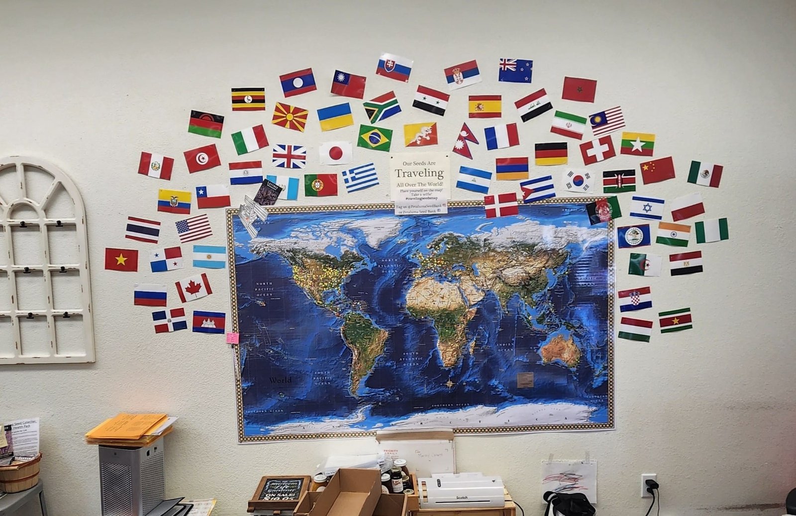
Seed store map of where they ship their heirloom seed. Source: Cartonaut


 FR
FR


