
ArcGIS
Utiliser les données libres en flux WMS/WMTS #
Intégration d’un flux WMTS #
Lire la suite →
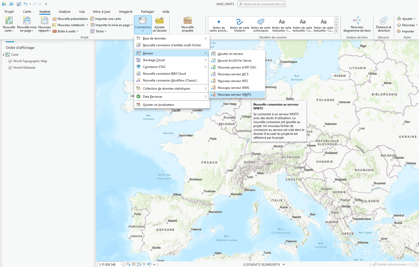
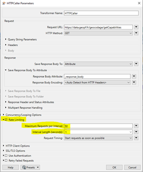
Dans le menu « Insérer », allez dans « Connexions » puis « Nouveau serveur WMTS ».
Dans la boîte de dialogue « Ajouter une connexion au serveur WMTS », renseignez le champ « URL du serveur » :
https://data.geopf.fr/wmts?SERVICE=WMTS&VERSION=1.0.0&REQUEST=GetCapabilitiesEt cliquez sur « OK ».
...


